Xin’andu geodata
Xin’andu (Hubei) is a seat of a fourth-order administrative division; located in China in Asia/Shanghai (GMT+8) time zone. In our database, there are 1268 cities with bigger population. Compared to other cities in China, 52.5% of cities are located further ↓South; 51.8% of cities are located further →East and 79.3% of cities have higher elevation than Xin’andu. Note1


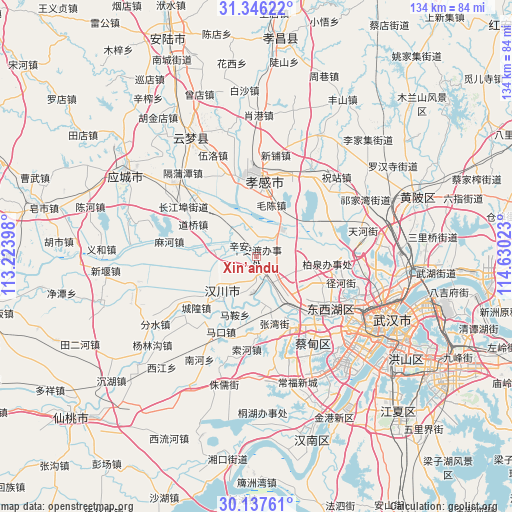
Xin’andu GPS coordinates[2]
30° 44' 37.716" North, 113° 55' 37.56" East
| Map corner | latitude | longitude |
|---|---|---|
| Upper-left | 31.34622°, | 113.22398° |
| Center: | 30.74381°, | 113.9271° |
| Lower-right: | 30.13761°, | 114.63023° |
| Map W x H: | 134.4×134.4 km | = 83.5×83.5mi |
| max Lat: | 53.31946° ⇑47.5% North |
| Xin’andu: | 30.74381° |
| min Lat: | ⇓52.5% South 18.22056° |
| min Long | Xin’andu | max Long |
| 75.07348° | 113.9271° | 134.28917° |
| W 48.2%⇐ | ⇒51.8% E |
Elevation
Elevation of Xin’andu is 28 m = 92 ft, and this is 456.8 m = 1499 ft below average elevation for this country.
| Max E: |
5622 m = 18445 ft | 79.3% |
| Avg. | 484.8 m = 1591 ft | |
| Xin’andu | 28 m = 92 ft | |
Min E: |
-3 m = -10 ft | 20.7% |
See also: China elevation on elevation.city.
Geographical zone
Xin’andu is located in North temperate zone (between Tropic of Cancer and the Arctic Circle). Distance of this Northern Tropic circle is 812.5 km =504.9 mi to South.| Distance of | km | miles | from Xin’andu |
|---|---|---|---|
| North Pole | 6588.7 | 4094 | to North |
| Arctic Circle | 3982.8 | 2474.8 | to North |
| Tropic Cancer | 812.5 | 504.9 | to South |
| Equator | 3418.4 | 2124.1 | to South |


Nearby cities:
15 places around Xin’andu: (largest is in red/bold)
• Daoqiao
18.6 km =11.6 mi,  296°
296°
• Dongshan
9.1 km =5.7 mi,  66°
66°
• Hanchuan
18.5 km =11.5 mi,  235°
235°
• Hebaohu
6.4 km =4 mi,  137°
137°
• Liujiage
11.4 km =7.1 mi,  277°
277°
• Maochen
14 km =8.7 mi,  16°
16°
• Maomiaoji
18.3 km =11.4 mi,  94°
94°
• Ma’an
16.4 km =10.2 mi,  200°
200°
• Wolong
18.3 km =11.4 mi,  350°
350°
• Xiannüshan
14.7 km =9.1 mi,  219°
219°
• Xiaxindian
13.3 km =8.3 mi,  318°
318°
• Xingou
12.9 km =8 mi,  155°
155°
• Xinhe
6.1 km =3.8 mi,  174°
174°
• Zhangwan
18.3 km =11.4 mi, 165°
• Zoumaling
13.2 km =8.2 mi, 139°
Sources, notices
• [Note1] Compared only with cities in China existing in our database
• [Src1] Map data: © OpenStreetMap contributors (CC-BY-SA)
• [Src2] Other city data from geonames.org with taken over terms of usage.
• [Src3] Geographical zone / Annual Mean Temperature by Robert A. Rohde @ Wikipedia
