Jinlong geodata
Jinlong (Heilongjiang) is a seat of a fourth-order administrative division; located in China in Asia/Urumqi (GMT+6) time zone. In our database, there are 1268 cities with bigger population. Compared to other cities in China, 94.5% of cities are located further ↓South; 98.6% of cities are located further →East and 61.1% of cities have lower elevation than Jinlong. Note1


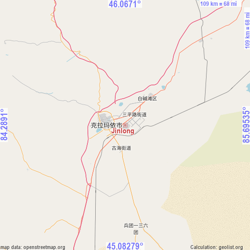
Jinlong GPS coordinates[2]
45° 34' 37.56" North, 84° 59' 31.992" East
| Map corner | latitude | longitude |
|---|---|---|
| Upper-left | 46.0671°, | 84.2891° |
| Center: | 45.5771°, | 84.99222° |
| Lower-right: | 45.08279°, | 85.69535° |
| Map W x H: | 109.4×109.4 km | = 68×68mi |
| max Lat: | 53.31946° ⇑5.5% North |
| Jinlong: | 45.5771° |
| min Lat: | ⇓94.5% South 18.22056° |
| min Long | Jinlong | max Long |
| 75.07348° | 84.99222° | 134.28917° |
| W 1.4%⇐ | ⇒98.6% E |
Elevation
Elevation of Jinlong is 273 m = 896 ft, and this is 211.8 m = 695 ft below average elevation for this country.
| Max E: |
5622 m = 18445 ft | 38.9% |
| Avg. | 484.8 m = 1591 ft | |
| Jinlong | 273 m = 896 ft | |
Min E: |
-3 m = -10 ft | 61.1% |
See also: China elevation on elevation.city.
Geographical zone
Jinlong is located in North temperate zone (between Tropic of Cancer and the Arctic Circle). Distance of this North polar circle is 2333.5 km =1450 mi to North.| Distance of | km | miles | from Jinlong |
|---|---|---|---|
| North Pole | 4939.4 | 3069.2 | to North |
| Arctic Circle | 2333.5 | 1450 | to North |
| Tropic Cancer | 2461.8 | 1529.7 | to South |
| Equator | 5067.7 | 3148.9 | to South |


Nearby cities:
15 places around Jinlong: (largest is in red/bold)
• Baijiantan
17.2 km =10.7 mi,  41°
41°
• Baikouquan
53.3 km =33.1 mi, 44°
• Dongpaizi
84.3 km =52.4 mi,  208°
208°
• Huanggong
111.9 km =69.5 mi,  188°
188°
• Karamay
8.2 km =5.1 mi,  275°
275°
• Lamazhao
90.6 km =56.3 mi,  326°
326°
• Miao’ergou
88.1 km =54.7 mi,  265°
265°
• Sanping
6.9 km =4.3 mi,  47°
47°
• Shiqiao
84.1 km =52.3 mi,  220°
220°
• Sidaohezi
113.5 km =70.5 mi,  150°
150°
• Tiechanggou
78.8 km =49 mi, 326°
• Toutai
98.7 km =61.3 mi,  196°
196°
• Urho
80.1 km =49.8 mi, 41°
• Wuxuete
98.2 km =61 mi,  305°
305°
• Xiaoguai
50 km =31.1 mi,  175°
175°
Sources, notices
• [Note1] Compared only with cities in China existing in our database
• [Src1] Map data: © OpenStreetMap contributors (CC-BY-SA)
• [Src2] Other city data from geonames.org with taken over terms of usage.
• [Src3] Geographical zone / Annual Mean Temperature by Robert A. Rohde @ Wikipedia
