Xiping geodata
Xiping (Yunnan) is a seat of a third-order administrative division; located in China in Asia/Shanghai (GMT+8) time zone. In our database, there are 1268 cities with bigger population. Compared to other cities in China, 83.9% of cities are located further ↑North; 90.6% of cities are located further →East and 93.9% of cities have lower elevation than Xiping. Note1


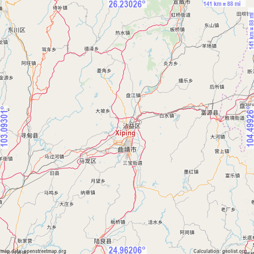
Xiping GPS coordinates[2]
25° 35' 52.224" North, 103° 47' 46.068" East
| Map corner | latitude | longitude |
|---|---|---|
| Upper-left | 26.23026°, | 103.09301° |
| Center: | 25.59784°, | 103.79613° |
| Lower-right: | 24.96206°, | 104.49926° |
| Map W x H: | 141×141 km | = 87.6×87.6mi |
| max Lat: | 53.31946° ⇑83.9% North |
| Xiping: | 25.59784° |
| min Lat: | ⇓16.1% South 18.22056° |
| min Long | Xiping | max Long |
| 75.07348° | 103.79613° | 134.28917° |
| W 9.4%⇐ | ⇒90.6% E |
Elevation
Elevation of Xiping is 1865 m = 6119 ft, and this is 1380.2 m = 4528 ft above average elevation for this country.
| Max E: |
5622 m = 18445 ft | 6.1% |
| Xiping | 1865 m 6119 ft | |
| Avg. | 484.8 m = 1591 ft | |
Min E: |
-3 m = -10 ft | 93.9% |
See also: China elevation on elevation.city.
Geographical zone
Xiping is located in North temperate zone (between Tropic of Cancer and the Arctic Circle). Distance of this Northern Tropic circle is 240.3 km =149.3 mi to South.| Distance of | km | miles | from Xiping |
|---|---|---|---|
| North Pole | 7160.8 | 4449.5 | to North |
| Arctic Circle | 4555 | 2830.3 | to North |
| Tropic Cancer | 240.3 | 149.3 | to South |
| Equator | 2846.2 | 1768.5 | to South |


Nearby cities:
15 places around Xiping: (largest is in red/bold)
• Beigucheng
92 km =57.2 mi,  222°
222°
• Chengfangqiao
18.1 km =11.2 mi,  11°
11°
• Danfeng
87.9 km =54.6 mi,  165°
165°
• Dasongshu
63.9 km =39.7 mi,  339°
339°
• Gaojiacun
46.3 km =28.8 mi,  144°
144°
• Jianxincun
42 km =26.1 mi,  50°
50°
• Machang
73.8 km =45.9 mi,  39°
39°
• Pingpo
19.3 km =12 mi,  192°
192°
• Qujing
12.8 km =8 mi, 185°
• Rende
52.3 km =32.5 mi,  265°
265°
• Songyang
82.7 km =51.4 mi,  248°
248°
• Tongquan
31.8 km =19.8 mi,  226°
226°
• Xiaotiechang
77.9 km =48.4 mi,  348°
348°
• Zhongshu
64.8 km =40.3 mi, 191°
• Zhong’an
44.5 km =27.7 mi,  80°
80°
Sources, notices
• [Note1] Compared only with cities in China existing in our database
• [Src1] Map data: © OpenStreetMap contributors (CC-BY-SA)
• [Src2] Other city data from geonames.org with taken over terms of usage.
• [Src3] Geographical zone / Annual Mean Temperature by Robert A. Rohde @ Wikipedia
