Chengfangqiao geodata
Chengfangqiao (Yunnan) is a seat of a fourth-order administrative division; located in China in Asia/Shanghai (GMT+8) time zone. In our database, there are 1268 cities with bigger population. Compared to other cities in China, 83.3% of cities are located further ↑North; 90.5% of cities are located further →East and 94.5% of cities have lower elevation than Chengfangqiao. Note1


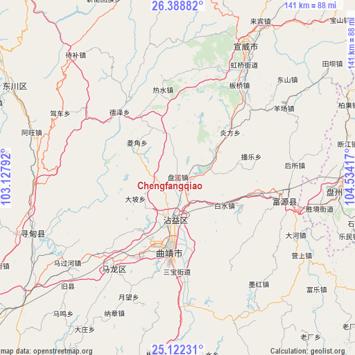
Chengfangqiao GPS coordinates[2]
25° 45' 26.1" North, 103° 49' 51.744" East
| Map corner | latitude | longitude |
|---|---|---|
| Upper-left | 26.38882°, | 103.12792° |
| Center: | 25.75725°, | 103.83104° |
| Lower-right: | 25.12231°, | 104.53417° |
| Map W x H: | 140.8×140.8 km | = 87.5×87.5mi |
| max Lat: | 53.31946° ⇑83.3% North |
| Chengfangqiao: | 25.75725° |
| min Lat: | ⇓16.7% South 18.22056° |
| min Long | Chengfangqiao | max Long |
| 75.07348° | 103.83104° | 134.28917° |
| W 9.5%⇐ | ⇒90.5% E |
Elevation
Elevation of Chengfangqiao is 1955 m = 6414 ft, and this is 1470.2 m = 4823 ft above average elevation for this country.
| Max E: |
5622 m = 18445 ft | 5.5% |
| Chengfangqiao | 1955 m 6414 ft | |
| Avg. | 484.8 m = 1591 ft | |
Min E: |
-3 m = -10 ft | 94.5% |
See also: China elevation on elevation.city.
Geographical zone
Chengfangqiao is located in North temperate zone (between Tropic of Cancer and the Arctic Circle). Distance of this Northern Tropic circle is 258 km =160.3 mi to South.| Distance of | km | miles | from Chengfangqiao |
|---|---|---|---|
| North Pole | 7143.1 | 4438.5 | to North |
| Arctic Circle | 4537.2 | 2819.3 | to North |
| Tropic Cancer | 258 | 160.3 | to South |
| Equator | 2863.9 | 1779.5 | to South |


Nearby cities:
15 places around Chengfangqiao: (largest is in red/bold)
• Dasongshu
49.4 km =30.7 mi,  328°
328°
• Gaojiacun
60.1 km =37.3 mi,  157°
157°
• Jianxincun
30.3 km =18.8 mi,  72°
72°
• Jinzhong
86.5 km =53.7 mi,  322°
322°
• Machang
58.6 km =36.4 mi,  48°
48°
• Pingpo
37.4 km =23.2 mi,  191°
191°
• Qujing
30.8 km =19.1 mi, 188°
• Rende
59.9 km =37.2 mi,  248°
248°
• Songyang
93.6 km =58.2 mi,  239°
239°
• Tongquan
47.8 km =29.7 mi,  213°
213°
• Xiaotiechang
61.6 km =38.3 mi,  341°
341°
• Xiping
18.1 km =11.2 mi, 191°
• Zhongshu
82.9 km =51.5 mi, 191°
• Zhong’an
41.5 km =25.8 mi,  104°
104°
• Zhujiacun
84.3 km =52.4 mi,  42°
42°
Sources, notices
• [Note1] Compared only with cities in China existing in our database
• [Src1] Map data: © OpenStreetMap contributors (CC-BY-SA)
• [Src2] Other city data from geonames.org with taken over terms of usage.
• [Src3] Geographical zone / Annual Mean Temperature by Robert A. Rohde @ Wikipedia
