Jianxincun geodata
Jianxincun (Yunnan) is a seat of a fourth-order administrative division; located in China in Asia/Shanghai (GMT+8) time zone. In our database, there are 1268 cities with bigger population. Compared to other cities in China, 83% of cities are located further ↑North; 90.1% of cities are located further →East and 94.9% of cities have lower elevation than Jianxincun. Note1


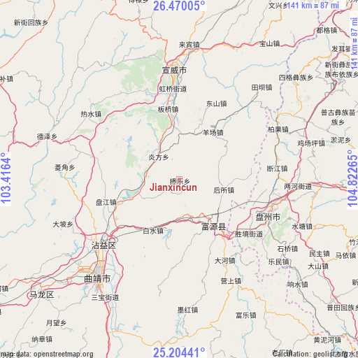
Jianxincun GPS coordinates[2]
25° 50' 20.112" North, 104° 7' 10.272" East
| Map corner | latitude | longitude |
|---|---|---|
| Upper-left | 26.47005°, | 103.4164° |
| Center: | 25.83892°, | 104.11952° |
| Lower-right: | 25.20441°, | 104.82265° |
| Map W x H: | 140.7×140.7 km | = 87.4×87.4mi |
| max Lat: | 53.31946° ⇑83% North |
| Jianxincun: | 25.83892° |
| min Lat: | ⇓17% South 18.22056° |
| min Long | Jianxincun | max Long |
| 75.07348° | 104.11952° | 134.28917° |
| W 9.9%⇐ | ⇒90.1% E |
Elevation
Elevation of Jianxincun is 2090 m = 6857 ft, and this is 1605.2 m = 5266 ft above average elevation for this country.
| Max E: |
5622 m = 18445 ft | 5.1% |
| Jianxincun | 2090 m 6857 ft | |
| Avg. | 484.8 m = 1591 ft | |
Min E: |
-3 m = -10 ft | 94.9% |
See also: China elevation on elevation.city.
Geographical zone
Jianxincun is located in North temperate zone (between Tropic of Cancer and the Arctic Circle). Distance of this Northern Tropic circle is 267.1 km =166 mi to South.| Distance of | km | miles | from Jianxincun |
|---|---|---|---|
| North Pole | 7134 | 4432.9 | to North |
| Arctic Circle | 4528.2 | 2813.7 | to North |
| Tropic Cancer | 267.1 | 166 | to South |
| Equator | 2873 | 1785.2 | to South |


Nearby cities:
15 places around Jianxincun: (largest is in red/bold)
• Chengfangqiao
30.3 km =18.8 mi,  252°
252°
• Dasongshu
63.9 km =39.7 mi,  301°
301°
• Gaojiacun
64.8 km =40.3 mi,  184°
184°
• Jinzhong
100.8 km =62.6 mi,  306°
306°
• Luoxiong
107.4 km =66.7 mi,  170°
170°
• Machang
33.4 km =20.8 mi,  26°
26°
• Pingpo
58.5 km =36.4 mi,  218°
218°
• Qujing
51.9 km =32.2 mi, 220°
• Rende
90.1 km =56 mi, 249°
• Tongquan
73.9 km =45.9 mi,  228°
228°
• Xiaotiechang
68.9 km =42.8 mi,  315°
315°
• Xiping
42 km =26.1 mi, 230°
• Zhongshu
101.2 km =62.9 mi,  206°
206°
• Zhong’an
22.3 km =13.9 mi,  149°
149°
• Zhujiacun
60.2 km =37.4 mi, 27°
Sources, notices
• [Note1] Compared only with cities in China existing in our database
• [Src1] Map data: © OpenStreetMap contributors (CC-BY-SA)
• [Src2] Other city data from geonames.org with taken over terms of usage.
• [Src3] Geographical zone / Annual Mean Temperature by Robert A. Rohde @ Wikipedia
