Xitieshan geodata
Xitieshan (Qinghai) is a seat of a fourth-order administrative division; located in China in Asia/Shanghai (GMT+8) time zone. In our database, there are 1268 cities with bigger population. Compared to other cities in China, 79.8% of cities are located further ↓South; 96% of cities are located further →East and 96.9% of cities have lower elevation than Xitieshan. Note1


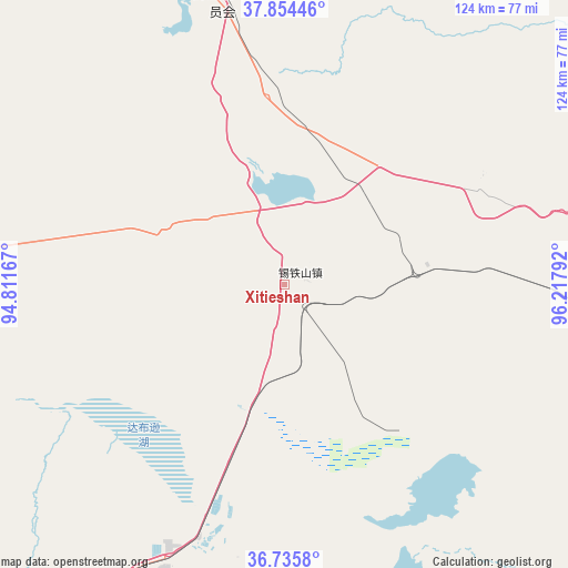
Xitieshan GPS coordinates[2]
37° 17' 49.956" North, 95° 30' 53.244" East
| Map corner | latitude | longitude |
|---|---|---|
| Upper-left | 37.85446°, | 94.81167° |
| Center: | 37.29721°, | 95.51479° |
| Lower-right: | 36.7358°, | 96.21792° |
| Map W x H: | 124.4×124.4 km | = 77.3×77.3mi |
| max Lat: | 53.31946° ⇑20.2% North |
| Xitieshan: | 37.29721° |
| min Lat: | ⇓79.8% South 18.22056° |
| min Long | Xitieshan | max Long |
| 75.07348° | 95.51479° | 134.28917° |
| W 4%⇐ | ⇒96% E |
Elevation
Elevation of Xitieshan is 3003 m = 9852 ft, and this is 2518.2 m = 8262 ft above average elevation for this country.
| Max E: |
5622 m = 18445 ft | 3.1% |
| Xitieshan | 3003 m 9852 ft | |
| Avg. | 484.8 m = 1591 ft | |
Min E: |
-3 m = -10 ft | 96.9% |
See also: China elevation on elevation.city.
Geographical zone
Xitieshan is located in North temperate zone (between Tropic of Cancer and the Arctic Circle). Distance of this Northern Tropic circle is 1541.1 km =957.6 mi to South.| Distance of | km | miles | from Xitieshan |
|---|---|---|---|
| North Pole | 5860 | 3641.2 | to North |
| Arctic Circle | 3254.1 | 2022 | to North |
| Tropic Cancer | 1541.1 | 957.6 | to South |
| Equator | 4147.1 | 2576.9 | to South |


Nearby cities:
15 places around Xitieshan: (largest is in red/bold)
• Barun
227.9 km =141.6 mi,  131°
131°
• Da Qaidam
62.5 km =38.8 mi,  342°
342°
• Dagur
99.8 km =62 mi,  168°
168°
• Delingha
164.6 km =102.3 mi,  86°
86°
• Golmud
113.1 km =70.3 mi,  208°
208°
• Guolemude
116.3 km =72.3 mi, 212°
• Haquxiang
114.3 km =71 mi, 212°
• Hoit Taria
109.4 km =68 mi, 86°
• Keluke
143.3 km =89 mi, 88°
• Nomhon
130.1 km =80.8 mi,  142°
142°
• Wutumeiren
213.1 km =132.4 mi,  258°
258°
• Xuji
205.1 km =127.4 mi, 88°
• Yanchiwan
194.5 km =120.9 mi,  15°
15°
• Zongjia
172.7 km =107.3 mi, 132°
• Zongwulong
162.5 km =101 mi, 86°
Sources, notices
• [Note1] Compared only with cities in China existing in our database
• [Src1] Map data: © OpenStreetMap contributors (CC-BY-SA)
• [Src2] Other city data from geonames.org with taken over terms of usage.
• [Src3] Geographical zone / Annual Mean Temperature by Robert A. Rohde @ Wikipedia
