Hoit Taria geodata
Hoit Taria (Qinghai) is a seat of a fourth-order administrative division; located in China in Asia/Shanghai (GMT+8) time zone. In our database, there are 1268 cities with bigger population. Compared to other cities in China, 79.9% of cities are located further ↓South; 95.7% of cities are located further →East and 96.6% of cities have lower elevation than Hoit Taria. Note1


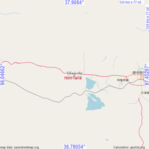
Hoit Taria GPS coordinates[2]
37° 21' 5.58" North, 96° 44' 59.064" East
| Map corner | latitude | longitude |
|---|---|---|
| Upper-left | 37.9084°, | 96.04662° |
| Center: | 37.35155°, | 96.74974° |
| Lower-right: | 36.79054°, | 97.45287° |
| Map W x H: | 124.3×124.3 km | = 77.2×77.2mi |
| max Lat: | 53.31946° ⇑20.1% North |
| Hoit Taria: | 37.35155° |
| min Lat: | ⇓79.9% South 18.22056° |
| min Long | Hoit Taria | max Long |
| 75.07348° | 96.74974° | 134.28917° |
| W 4.3%⇐ | ⇒95.7% E |
Elevation
Elevation of Hoit Taria is 2875 m = 9432 ft, and this is 2390.2 m = 7842 ft above average elevation for this country.
| Max E: |
5622 m = 18445 ft | 3.4% |
| Hoit Taria | 2875 m 9432 ft | |
| Avg. | 484.8 m = 1591 ft | |
Min E: |
-3 m = -10 ft | 96.6% |
See also: China elevation on elevation.city.
Geographical zone
Hoit Taria is located in North temperate zone (between Tropic of Cancer and the Arctic Circle). Distance of this Northern Tropic circle is 1547.2 km =961.4 mi to South.| Distance of | km | miles | from Hoit Taria |
|---|---|---|---|
| North Pole | 5854 | 3637.5 | to North |
| Arctic Circle | 3248.1 | 2018.3 | to North |
| Tropic Cancer | 1547.2 | 961.4 | to South |
| Equator | 4153.1 | 2580.6 | to South |


Nearby cities:
15 places around Hoit Taria: (largest is in red/bold)
• Barun
169 km =105 mi,  159°
159°
• Da Qaidam
138.5 km =86.1 mi,  292°
292°
• Dagur
137.8 km =85.6 mi,  221°
221°
• Delingha
55.3 km =34.4 mi,  87°
87°
• Keluke
34.2 km =21.3 mi,  95°
95°
• Nomhon
113.2 km =70.3 mi,  195°
195°
• Qagan Us
154.5 km =96 mi,  133°
133°
• Serh
150.8 km =93.7 mi,  107°
107°
• Tongpu
160.4 km =99.7 mi, 104°
• Xarag
165.7 km =103 mi, 129°
• Xireg
157.8 km =98.1 mi, 107°
• Xitieshan
109.4 km =68 mi,  266°
266°
• Xuji
95.7 km =59.5 mi, 90°
• Zongjia
123.6 km =76.8 mi,  171°
171°
• Zongwulong
53.1 km =33 mi, 86°
Sources, notices
• [Note1] Compared only with cities in China existing in our database
• [Src1] Map data: © OpenStreetMap contributors (CC-BY-SA)
• [Src2] Other city data from geonames.org with taken over terms of usage.
• [Src3] Geographical zone / Annual Mean Temperature by Robert A. Rohde @ Wikipedia
