Keluke geodata
Keluke (Qinghai) is a seat of a fourth-order administrative division; located in China in Asia/Shanghai (GMT+8) time zone. In our database, there are 1268 cities with bigger population. Compared to other cities in China, 79.8% of cities are located further ↓South; 95.6% of cities are located further →East and 96.6% of cities have lower elevation than Keluke. Note1


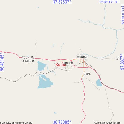
Keluke GPS coordinates[2]
37° 19' 16.644" North, 97° 8' 4.452" East
| Map corner | latitude | longitude |
|---|---|---|
| Upper-left | 37.87837°, | 96.43145° |
| Center: | 37.32129°, | 97.13457° |
| Lower-right: | 36.76005°, | 97.8377° |
| Map W x H: | 124.3×124.3 km | = 77.2×77.2mi |
| max Lat: | 53.31946° ⇑20.2% North |
| Keluke: | 37.32129° |
| min Lat: | ⇓79.8% South 18.22056° |
| min Long | Keluke | max Long |
| 75.07348° | 97.13457° | 134.28917° |
| W 4.4%⇐ | ⇒95.6% E |
Elevation
Elevation of Keluke is 2881 m = 9452 ft, and this is 2396.2 m = 7862 ft above average elevation for this country.
| Max E: |
5622 m = 18445 ft | 3.4% |
| Keluke | 2881 m 9452 ft | |
| Avg. | 484.8 m = 1591 ft | |
Min E: |
-3 m = -10 ft | 96.6% |
See also: China elevation on elevation.city.
Geographical zone
Keluke is located in North temperate zone (between Tropic of Cancer and the Arctic Circle). Distance of this Northern Tropic circle is 1543.8 km =959.3 mi to South.| Distance of | km | miles | from Keluke |
|---|---|---|---|
| North Pole | 5857.3 | 3639.6 | to North |
| Arctic Circle | 3251.4 | 2020.3 | to North |
| Tropic Cancer | 1543.8 | 959.3 | to South |
| Equator | 4149.7 | 2578.5 | to South |


Nearby cities:
15 places around Keluke: (largest is in red/bold)
• Delingha
22.1 km =13.7 mi,  73°
73°
• Hoit Taria
34.2 km =21.3 mi,  275°
275°
• Karmar
150.5 km =93.5 mi,  88°
88°
• Nomhon
123.9 km =77 mi,  211°
211°
• Qagan Us
129 km =80.2 mi,  142°
142°
• Reshui
153.2 km =95.2 mi, 143°
• Serh
117.5 km =73 mi,  110°
110°
• Tongpu
126.7 km =78.7 mi, 107°
• Xarag
138.6 km =86.1 mi, 137°
• Xireg
124.5 km =77.4 mi, 111°
• Xitieshan
143.3 km =89 mi,  268°
268°
• Xuji
61.8 km =38.4 mi, 87°
• Yangkang
148.1 km =92 mi, 74°
• Zongjia
120.1 km =74.6 mi,  187°
187°
• Zongwulong
20.3 km =12.6 mi, 69°
Sources, notices
• [Note1] Compared only with cities in China existing in our database
• [Src1] Map data: © OpenStreetMap contributors (CC-BY-SA)
• [Src2] Other city data from geonames.org with taken over terms of usage.
• [Src3] Geographical zone / Annual Mean Temperature by Robert A. Rohde @ Wikipedia
