Ngamring geodata
Ngamring (Tibet) is a seat of a third-order administrative division; located in China in Asia/Shanghai (GMT+8) time zone. In our database, there are 1268 cities with bigger population. Compared to other cities in China, 62.9% of cities are located further ↑North; 98.2% of cities are located further →East and 99.8% of cities have lower elevation than Ngamring. Note1


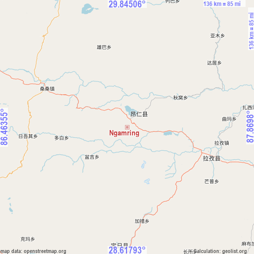
Ngamring GPS coordinates[2]
29° 13' 59.988" North, 87° 10' 0.012" East
| Map corner | latitude | longitude |
|---|---|---|
| Upper-left | 29.84506°, | 86.46355° |
| Center: | 29.23333°, | 87.16667° |
| Lower-right: | 28.61793°, | 87.8698° |
| Map W x H: | 136.4×136.4 km | = 84.8×84.8mi |
| max Lat: | 53.31946° ⇑62.9% North |
| Ngamring: | 29.23333° |
| min Lat: | ⇓37.1% South 18.22056° |
| min Long | Ngamring | max Long |
| 75.07348° | 87.16667° | 134.28917° |
| W 1.8%⇐ | ⇒98.2% E |
Elevation
Elevation of Ngamring is 4721 m = 15489 ft, and this is 4236.2 m = 13898 ft above average elevation for this country.
| Max E: |
5622 m = 18445 ft | 0.2% |
| Ngamring | 4721 m 15489 ft | |
| Avg. | 484.8 m = 1591 ft | |
Min E: |
-3 m = -10 ft | 99.8% |
See also: China elevation on elevation.city.
Geographical zone
Ngamring is located in North temperate zone (between Tropic of Cancer and the Arctic Circle). Distance of this Northern Tropic circle is 644.5 km =400.5 mi to South.| Distance of | km | miles | from Ngamring |
|---|---|---|---|
| North Pole | 6756.6 | 4198.4 | to North |
| Arctic Circle | 4150.7 | 2579.1 | to North |
| Tropic Cancer | 644.5 | 400.5 | to South |
| Equator | 3250.4 | 2019.7 | to South |


Nearby cities:
15 places around Ngamring: (largest is in red/bold)
• Bianxiong
183 km =113.7 mi,  87°
87°
• Camgyai
161.1 km =100.1 mi,  211°
211°
• Chongdui
168 km =104.4 mi,  224°
224°
• Gangba
170.4 km =105.9 mi,  131°
131°
• Gyangkar
111.3 km =69.2 mi,  146°
146°
• Jiding
106.1 km =65.9 mi,  81°
81°
• Kambaxoi
168.9 km =104.9 mi, 127°
• Qum
184.6 km =114.7 mi, 76°
• Quxar
49.2 km =30.6 mi,  107°
107°
• Renwu
182.8 km =113.6 mi, 76°
• Rikaze
166.6 km =103.5 mi, 89°
• Sajia
92.8 km =57.7 mi, 112°
• Xêgar
67.2 km =41.8 mi,  186°
186°
• Zham
180.7 km =112.3 mi, 219°
• Zuobude
160.7 km =99.9 mi, 211°
Sources, notices
• [Note1] Compared only with cities in China existing in our database
• [Src1] Map data: © OpenStreetMap contributors (CC-BY-SA)
• [Src2] Other city data from geonames.org with taken over terms of usage.
• [Src3] Geographical zone / Annual Mean Temperature by Robert A. Rohde @ Wikipedia
