Karjaw geodata
Karjaw (Xinjiang) is a seat of a fourth-order administrative division; located in China in Asia/Urumqi (GMT+6) time zone. In our database, there are 1268 cities with bigger population. Compared to other cities in China, 97.3% of cities are located further ↓South; 98.2% of cities are located further →East and 89.2% of cities have lower elevation than Karjaw. Note1


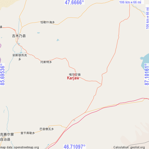
Karjaw GPS coordinates[2]
47° 11' 27.384" North, 86° 23' 54.528" East
| Map corner | latitude | longitude |
|---|---|---|
| Upper-left | 47.6666°, | 85.69536° |
| Center: | 47.19094°, | 86.39848° |
| Lower-right: | 46.71097°, | 87.10161° |
| Map W x H: | 106.3×106.3 km | = 66.1×66.1mi |
| max Lat: | 53.31946° ⇑2.7% North |
| Karjaw: | 47.19094° |
| min Lat: | ⇓97.3% South 18.22056° |
| min Long | Karjaw | max Long |
| 75.07348° | 86.39848° | 134.28917° |
| W 1.8%⇐ | ⇒98.2% E |
Elevation
Elevation of Karjaw is 1292 m = 4239 ft, and this is 807.2 m = 2648 ft above average elevation for this country.
| Max E: |
5622 m = 18445 ft | 10.8% |
| Karjaw | 1292 m 4239 ft | |
| Avg. | 484.8 m = 1591 ft | |
Min E: |
-3 m = -10 ft | 89.2% |
See also: China elevation on elevation.city.
Geographical zone
Karjaw is located in North temperate zone (between Tropic of Cancer and the Arctic Circle). Distance of this North polar circle is 2154 km =1338.4 mi to North.| Distance of | km | miles | from Karjaw |
|---|---|---|---|
| North Pole | 4759.9 | 2957.7 | to North |
| Arctic Circle | 2154 | 1338.4 | to North |
| Tropic Cancer | 2641.2 | 1641.2 | to South |
| Equator | 5247.1 | 3260.4 | to South |


Nearby cities:
15 places around Karjaw: (largest is in red/bold)
• A’erda
84.1 km =52.3 mi,  94°
94°
• Bayinaobao
43.3 km =26.9 mi,  207°
207°
• Besterek
41.1 km =25.5 mi,  287°
287°
• Egiztobe
87.2 km =54.2 mi,  31°
31°
• Fuhai
82.9 km =51.5 mi,  96°
96°
• Hoboksar
67.3 km =41.8 mi,  229°
229°
• Hoxtolgay
80.6 km =50.1 mi,  201°
201°
• Jeminay
68.1 km =42.3 mi,  300°
300°
• Jetaral
79.8 km =49.6 mi, 97°
• Motge
62 km =38.5 mi, 227°
• Qagan Hol
53.5 km =33.2 mi,  218°
218°
• Tiebukenwusan
83.7 km =52 mi,  239°
239°
• Topterek
48.1 km =29.9 mi, 304°
• Tost
22.4 km =13.9 mi, 294°
• Xalxikay
39.3 km =24.4 mi,  339°
339°
Sources, notices
• [Note1] Compared only with cities in China existing in our database
• [Src1] Map data: © OpenStreetMap contributors (CC-BY-SA)
• [Src2] Other city data from geonames.org with taken over terms of usage.
• [Src3] Geographical zone / Annual Mean Temperature by Robert A. Rohde @ Wikipedia
