Motge geodata
Motge (Xinjiang) is a seat of a fourth-order administrative division; located in China in Asia/Urumqi (GMT+6) time zone. In our database, there are 1268 cities with bigger population. Compared to other cities in China, 96.6% of cities are located further ↓South; 98.4% of cities are located further →East and 89.2% of cities have lower elevation than Motge. Note1


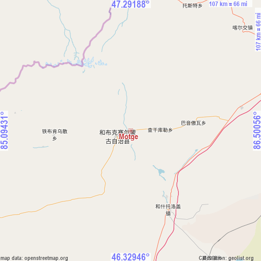
Motge GPS coordinates[2]
46° 48' 46.152" North, 85° 47' 50.748" East
| Map corner | latitude | longitude |
|---|---|---|
| Upper-left | 47.29188°, | 85.09431° |
| Center: | 46.81282°, | 85.79743° |
| Lower-right: | 46.32946°, | 86.50056° |
| Map W x H: | 107×107 km | = 66.5×66.5mi |
| max Lat: | 53.31946° ⇑3.4% North |
| Motge: | 46.81282° |
| min Lat: | ⇓96.6% South 18.22056° |
| min Long | Motge | max Long |
| 75.07348° | 85.79743° | 134.28917° |
| W 1.6%⇐ | ⇒98.4% E |
Elevation
Elevation of Motge is 1285 m = 4216 ft, and this is 800.2 m = 2625 ft above average elevation for this country.
| Max E: |
5622 m = 18445 ft | 10.8% |
| Motge | 1285 m 4216 ft | |
| Avg. | 484.8 m = 1591 ft | |
Min E: |
-3 m = -10 ft | 89.2% |
See also: China elevation on elevation.city.
Geographical zone
Motge is located in North temperate zone (between Tropic of Cancer and the Arctic Circle). Distance of this North polar circle is 2196.1 km =1364.6 mi to North.| Distance of | km | miles | from Motge |
|---|---|---|---|
| North Pole | 4802 | 2983.8 | to North |
| Arctic Circle | 2196.1 | 1364.6 | to North |
| Tropic Cancer | 2599.2 | 1615.1 | to South |
| Equator | 5205.1 | 3234.3 | to South |


Nearby cities:
15 places around Motge: (largest is in red/bold)
• Baikouquan
102.5 km =63.7 mi,  193°
193°
• Bayinaobao
26 km =16.2 mi,  82°
82°
• Besterek
55 km =34.2 mi,  6°
6°
• Hoboksar
5.7 km =3.5 mi,  249°
249°
• Hoxtolgay
36.2 km =22.5 mi,  154°
154°
• Jeminay
77.6 km =48.2 mi,  349°
349°
• Kalayemule
109.7 km =68.2 mi,  266°
266°
• Karjaw
62 km =38.5 mi,  47°
47°
• Qagan Hol
12 km =7.5 mi,  87°
87°
• Tiebukenwusan
26.3 km =16.3 mi, 267°
• Topterek
69.3 km =43.1 mi,  4°
4°
• Tost
57.1 km =35.5 mi,  26°
26°
• Urho
78 km =48.5 mi, 186°
• Xalxikay
85 km =52.8 mi,  21°
21°
• Xazgat
62 km =38.5 mi, 147°
Sources, notices
• [Note1] Compared only with cities in China existing in our database
• [Src1] Map data: © OpenStreetMap contributors (CC-BY-SA)
• [Src2] Other city data from geonames.org with taken over terms of usage.
• [Src3] Geographical zone / Annual Mean Temperature by Robert A. Rohde @ Wikipedia
