Qagan Hol geodata
Qagan Hol (Xinjiang) is a seat of a fourth-order administrative division; located in China in Asia/Urumqi (GMT+6) time zone. In our database, there are 1268 cities with bigger population. Compared to other cities in China, 96.6% of cities are located further ↓South; 98.4% of cities are located further →East and 88.9% of cities have lower elevation than Qagan Hol. Note1


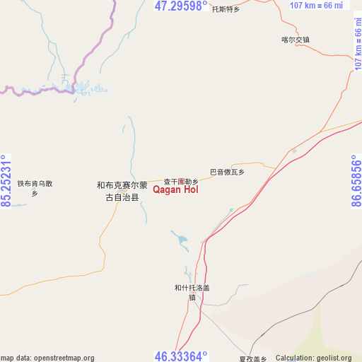
Qagan Hol GPS coordinates[2]
46° 49' 1.056" North, 85° 57' 19.548" East
| Map corner | latitude | longitude |
|---|---|---|
| Upper-left | 47.29598°, | 85.25231° |
| Center: | 46.81696°, | 85.95543° |
| Lower-right: | 46.33364°, | 86.65856° |
| Map W x H: | 107×107 km | = 66.5×66.5mi |
| max Lat: | 53.31946° ⇑3.4% North |
| Qagan Hol: | 46.81696° |
| min Lat: | ⇓96.6% South 18.22056° |
| min Long | Qagan Hol | max Long |
| 75.07348° | 85.95543° | 134.28917° |
| W 1.6%⇐ | ⇒98.4% E |
Elevation
Elevation of Qagan Hol is 1261 m = 4137 ft, and this is 776.2 m = 2547 ft above average elevation for this country.
| Max E: |
5622 m = 18445 ft | 11.1% |
| Qagan Hol | 1261 m 4137 ft | |
| Avg. | 484.8 m = 1591 ft | |
Min E: |
-3 m = -10 ft | 88.9% |
See also: China elevation on elevation.city.
Geographical zone
Qagan Hol is located in North temperate zone (between Tropic of Cancer and the Arctic Circle). Distance of this North polar circle is 2195.6 km =1364.3 mi to North.| Distance of | km | miles | from Qagan Hol |
|---|---|---|---|
| North Pole | 4801.5 | 2983.5 | to North |
| Arctic Circle | 2195.6 | 1364.3 | to North |
| Tropic Cancer | 2599.6 | 1615.3 | to South |
| Equator | 5205.6 | 3234.6 | to South |


Nearby cities:
15 places around Qagan Hol: (largest is in red/bold)
• Baikouquan
106.5 km =66.2 mi,  200°
200°
• Bayinaobao
14.1 km =8.8 mi,  77°
77°
• Besterek
54.5 km =33.9 mi,  353°
353°
• Hoboksar
17.6 km =10.9 mi,  262°
262°
• Hoxtolgay
33.4 km =20.8 mi,  173°
173°
• Jeminay
80.1 km =49.8 mi,  341°
341°
• Jetaral
117.3 km =72.9 mi,  74°
74°
• Karjaw
53.5 km =33.2 mi,  38°
38°
• Motge
12 km =7.5 mi,  267°
267°
• Tiebukenwusan
38.4 km =23.9 mi, 267°
• Topterek
68.9 km =42.8 mi, 354°
• Tost
52.5 km =32.6 mi,  14°
14°
• Urho
80.7 km =50.1 mi, 195°
• Xalxikay
80.9 km =50.3 mi, 14°
• Xazgat
56.8 km =35.3 mi,  157°
157°
Sources, notices
• [Note1] Compared only with cities in China existing in our database
• [Src1] Map data: © OpenStreetMap contributors (CC-BY-SA)
• [Src2] Other city data from geonames.org with taken over terms of usage.
• [Src3] Geographical zone / Annual Mean Temperature by Robert A. Rohde @ Wikipedia
