Topterek geodata
Topterek (Xinjiang) is a seat of a third-order administrative division; located in China in Asia/Urumqi (GMT+6) time zone. In our database, there are 1268 cities with bigger population. Compared to other cities in China, 97.8% of cities are located further ↓South; 98.4% of cities are located further →East and 85% of cities have lower elevation than Topterek. Note1


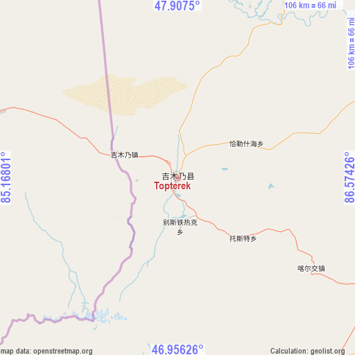
Topterek GPS coordinates[2]
47° 26' 2.508" North, 85° 52' 16.068" East
| Map corner | latitude | longitude |
|---|---|---|
| Upper-left | 47.9075°, | 85.16801° |
| Center: | 47.43403°, | 85.87113° |
| Lower-right: | 46.95626°, | 86.57426° |
| Map W x H: | 105.8×105.8 km | = 65.7×65.7mi |
| max Lat: | 53.31946° ⇑2.2% North |
| Topterek: | 47.43403° |
| min Lat: | ⇓97.8% South 18.22056° |
| min Long | Topterek | max Long |
| 75.07348° | 85.87113° | 134.28917° |
| W 1.6%⇐ | ⇒98.4% E |
Elevation
Elevation of Topterek is 984 m = 3228 ft, and this is 499.2 m = 1638 ft above average elevation for this country.
| Max E: |
5622 m = 18445 ft | 15% |
| Topterek | 984 m 3228 ft | |
| Avg. | 484.8 m = 1591 ft | |
Min E: |
-3 m = -10 ft | 85% |
See also: China elevation on elevation.city.
Geographical zone
Topterek is located in North temperate zone (between Tropic of Cancer and the Arctic Circle). Distance of this North polar circle is 2127 km =1321.7 mi to North.| Distance of | km | miles | from Topterek |
|---|---|---|---|
| North Pole | 4732.9 | 2940.9 | to North |
| Arctic Circle | 2127 | 1321.7 | to North |
| Tropic Cancer | 2668.3 | 1658 | to South |
| Equator | 5274.2 | 3277.2 | to South |


Nearby cities:
15 places around Topterek: (largest is in red/bold)
• Bayinaobao
68.5 km =42.6 mi,  163°
163°
• Besterek
14.5 km =9 mi,  177°
177°
• Egiztobe
97.2 km =60.4 mi,  60°
60°
• Hoboksar
71.9 km =44.7 mi,  188°
188°
• Hoxtolgay
102.3 km =63.6 mi,  174°
174°
• Jeminay
20.4 km =12.7 mi,  291°
291°
• Kalaxilike
123.5 km =76.7 mi,  74°
74°
• Karjaw
48.1 km =29.9 mi,  124°
124°
• Kostik
116.2 km =72.2 mi, 70°
• Motge
69.3 km =43.1 mi, 184°
• Oymak
97.2 km =60.4 mi, 59°
• Qagan Hol
68.9 km =42.8 mi, 174°
• Tiebukenwusan
76.9 km =47.8 mi,  204°
204°
• Tost
26.3 km =16.3 mi,  132°
132°
• Xalxikay
27.7 km =17.2 mi, 69°
Sources, notices
• [Note1] Compared only with cities in China existing in our database
• [Src1] Map data: © OpenStreetMap contributors (CC-BY-SA)
• [Src2] Other city data from geonames.org with taken over terms of usage.
• [Src3] Geographical zone / Annual Mean Temperature by Robert A. Rohde @ Wikipedia
