Silos geodata
Silos (Norte de Santander) is a seat of a second-order administrative division; located in Colombia in America/Bogota (GMT-5) time zone. With population of 1,300 people, there are 902 cities with bigger population in this country. Compared to other cities in Colombia, 76.2% of cities are located further ↓South; 91.4% of cities are located further ←West and 96.4% of cities have lower elevation than Silos. Note1


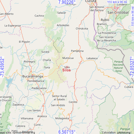
Silos GPS coordinates[2]
7° 12' 18.864" North, 72° 45' 23.004" West
| Map corner | latitude | longitude |
|---|---|---|
| Upper-left | 7.90226°, | -73.45952° |
| Center: | 7.20524°, | -72.75639° |
| Lower-right: | 6.50715°, | -72.05327° |
| Map W x H: | 155.1×155.1 km | = 96.4×96.4mi |
| max Lat: | 13.38166° ⇑23.8% North |
| Silos: | 7.20524° |
| min Lat: | ⇓76.2% South -4.21528° |
| min Long | Silos | max Long |
| -81.70636° | -72.75639° | -67.06996° |
| W 91.4%⇐ | ⇒8.6% E |
Elevation
Elevation of Silos is 2730 m = 8957 ft, and this is 1580.7 m = 5186 ft above average elevation for this country.
| Max E: |
3342 m = 10965 ft | 3.6% |
| Silos | 2730 m 8957 ft | |
| Avg. | 1149.3 m = 3771 ft | |
Min E: |
1 m = 3 ft | 96.4% |
See also: Colombia elevation on elevation.city.
Geographical zone
Silos is located in North Torrid zone (between Equator and Tropic of Cancer). Distance of Equator is 801.1 km =497.8 mi to South.| Distance of | km | miles | from Silos |
|---|---|---|---|
| North Pole | 9205.9 | 5720.3 | to North |
| Arctic Circle | 6600 | 4101 | to North |
| Tropic Cancer | 1804.8 | 1121.5 | to North |
| Equator | 801.1 | 497.8 | to South |


Nearby cities:
15 places around Silos: (largest is in red/bold)
• California
26.2 km =16.3 mi,  307°
307°
• Charta
24.8 km =15.4 mi,  289°
289°
• Chitagá
12.6 km =7.8 mi,  126°
126°
• Cucutilla
37.2 km =23.1 mi,  357°
357°
• Cácota
14.4 km =8.9 mi,  61°
61°
• Labateca
30.7 km =19.1 mi,  70°
70°
• Matanza
31.4 km =19.5 mi, 294°
• Mutiscua
10.7 km =6.6 mi,  5°
5°
• Pamplona
22.4 km =13.9 mi,  32°
32°
• Pamplonita
28.8 km =17.9 mi, 26°
• Santa Bárbara
29.1 km =18.1 mi,  214°
214°
• Suratá
30.8 km =19.1 mi, 305°
• Toledo
32.3 km =20.1 mi, 68°
• Tona
23 km =14.3 mi,  269°
269°
• Vetas
17.1 km =10.6 mi, 312°
Sources, notices
• [Note1] Compared only with cities in Colombia existing in our database
• [Src1] Map data: © OpenStreetMap contributors (CC-BY-SA)
• [Src2] Other city data from geonames.org with taken over terms of usage.
• [Src3] Geographical zone / Annual Mean Temperature by Robert A. Rohde @ Wikipedia
