Labateca geodata
Labateca (Norte de Santander) is a seat of a second-order administrative division; located in Colombia in America/Bogota (GMT-5) time zone. In our database, there are 1053 cities with bigger population. Compared to other cities in Colombia, 76.7% of cities are located further ↓South; 95.6% of cities are located further ←West and 63.2% of cities have lower elevation than Labateca. Note1


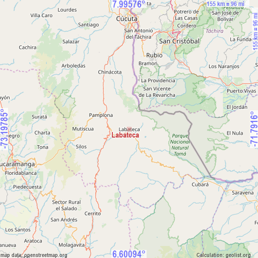
Labateca GPS coordinates[2]
7° 17' 56.004" North, 72° 29' 40.992" West
| Map corner | latitude | longitude |
|---|---|---|
| Upper-left | 7.99576°, | -73.19785° |
| Center: | 7.29889°, | -72.49472° |
| Lower-right: | 6.60094°, | -71.7916° |
| Map W x H: | 155.1×155.1 km | = 96.4×96.4mi |
| max Lat: | 13.38166° ⇑23.3% North |
| Labateca: | 7.29889° |
| min Lat: | ⇓76.7% South -4.21528° |
| min Long | Labateca | max Long |
| -81.70636° | -72.49472° | -67.06996° |
| W 95.6%⇐ | ⇒4.4% E |
Elevation
Elevation of Labateca is 1553 m = 5095 ft, and this is 403.7 m = 1324 ft above average elevation for this country.
| Max E: |
3342 m = 10965 ft | 36.8% |
| Labateca | 1553 m 5095 ft | |
| Avg. | 1149.3 m = 3771 ft | |
Min E: |
1 m = 3 ft | 63.2% |
See also: Colombia elevation on elevation.city.
Geographical zone
Labateca is located in North Torrid zone (between Equator and Tropic of Cancer). Distance of Equator is 811.6 km =504.3 mi to South.| Distance of | km | miles | from Labateca |
|---|---|---|---|
| North Pole | 9195.5 | 5713.8 | to North |
| Arctic Circle | 6589.6 | 4094.6 | to North |
| Tropic Cancer | 1794.4 | 1115 | to North |
| Equator | 811.6 | 504.3 | to South |


Nearby cities:
15 places around Labateca: (largest is in red/bold)
• Bochalema
38.6 km =24 mi,  334°
334°
• California
50 km =31.1 mi,  276°
276°
• Chinácota
36.2 km =22.5 mi,  341°
341°
• Chitagá
25.9 km =16.1 mi,  226°
226°
• Cucutilla
40.7 km =25.3 mi,  311°
311°
• Cácota
16.6 km =10.3 mi,  258°
258°
• Durania
49.4 km =30.7 mi, 338°
• Herrán
23.1 km =14.4 mi,  3°
3°
• Mutiscua
27.8 km =17.3 mi,  270°
270°
• Pamplona
18.9 km =11.7 mi,  296°
296°
• Pamplonita
22 km =13.7 mi, 314°
• Ragonvalia
31 km =19.3 mi, 3°
• Silos
30.7 km =19.1 mi,  250°
250°
• Toledo
1.8 km =1.1 mi,  46°
46°
• Vetas
41.5 km =25.8 mi, 271°
Sources, notices
• [Note1] Compared only with cities in Colombia existing in our database
• [Src1] Map data: © OpenStreetMap contributors (CC-BY-SA)
• [Src2] Other city data from geonames.org with taken over terms of usage.
• [Src3] Geographical zone / Annual Mean Temperature by Robert A. Rohde @ Wikipedia
