Cácota geodata
Cácota (Norte de Santander) is a seat of a second-order administrative division; located in Colombia in America/Bogota (GMT-5) time zone. With population of 1,415 people, there are 881 cities with bigger population in this country. Compared to other cities in Colombia, 76.5% of cities are located further ↓South; 93.8% of cities are located further ←West and 87.1% of cities have lower elevation than Cácota. Note1


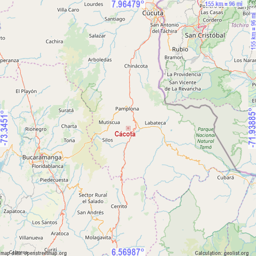
Cácota GPS coordinates[2]
7° 16' 4.332" North, 72° 38' 31.092" West
| Map corner | latitude | longitude |
|---|---|---|
| Upper-left | 7.96479°, | -73.3451° |
| Center: | 7.26787°, | -72.64197° |
| Lower-right: | 6.56987°, | -71.93885° |
| Map W x H: | 155.1×155.1 km | = 96.4×96.4mi |
| max Lat: | 13.38166° ⇑23.5% North |
| Cácota: | 7.26787° |
| min Lat: | ⇓76.5% South -4.21528° |
| min Long | Cácota | max Long |
| -81.70636° | -72.64197° | -67.06996° |
| W 93.8%⇐ | ⇒6.2% E |
Elevation
Elevation of Cácota is 2407 m = 7897 ft, and this is 1257.7 m = 4126 ft above average elevation for this country.
| Max E: |
3342 m = 10965 ft | 12.9% |
| Cácota | 2407 m 7897 ft | |
| Avg. | 1149.3 m = 3771 ft | |
Min E: |
1 m = 3 ft | 87.1% |
See also: Colombia elevation on elevation.city.
Geographical zone
Cácota is located in North Torrid zone (between Equator and Tropic of Cancer). Distance of Equator is 808.1 km =502.1 mi to South.| Distance of | km | miles | from Cácota |
|---|---|---|---|
| North Pole | 9199 | 5716 | to North |
| Arctic Circle | 6593.1 | 4096.8 | to North |
| Tropic Cancer | 1797.8 | 1117.1 | to North |
| Equator | 808.1 | 502.1 | to South |


Nearby cities:
15 places around Cácota: (largest is in red/bold)
• Bochalema
38.2 km =23.7 mi,  359°
359°
• California
34.7 km =21.6 mi,  284°
284°
• Charta
36 km =22.4 mi,  272°
272°
• Chinácota
38 km =23.6 mi,  6°
6°
• Chitagá
14.7 km =9.1 mi,  189°
189°
• Cucutilla
33.4 km =20.8 mi,  334°
334°
• Herrán
31.7 km =19.7 mi,  33°
33°
• Labateca
16.6 km =10.3 mi,  78°
78°
• Mutiscua
12.1 km =7.5 mi,  287°
287°
• Pamplona
12 km =7.5 mi, 356°
• Pamplonita
18.7 km =11.6 mi,  1°
1°
• Silos
14.4 km =8.9 mi,  241°
241°
• Toledo
18.1 km =11.2 mi, 75°
• Tona
36.4 km =22.6 mi,  258°
258°
• Vetas
25.7 km =16 mi, 280°
Sources, notices
• [Note1] Compared only with cities in Colombia existing in our database
• [Src1] Map data: © OpenStreetMap contributors (CC-BY-SA)
• [Src2] Other city data from geonames.org with taken over terms of usage.
• [Src3] Geographical zone / Annual Mean Temperature by Robert A. Rohde @ Wikipedia
