Pueblo Bello geodata
Pueblo Bello (Cesar) is a seat of a second-order administrative division; located in Colombia in America/Bogota (GMT-5) time zone. In our database, there are 1053 cities with bigger population. Compared to other cities in Colombia, 95.5% of cities are located further ↓South; 73.9% of cities are located further ←West and 50.6% of cities have higher elevation than Pueblo Bello. Note1


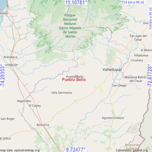
Pueblo Bello GPS coordinates[2]
10° 25' 1.416" North, 73° 34' 49.44" West
| Map corner | latitude | longitude |
|---|---|---|
| Upper-left | 11.10781°, | -74.28353° |
| Center: | 10.41706°, | -73.5804° |
| Lower-right: | 9.72477°, | -72.87728° |
| Map W x H: | 153.8×153.8 km | = 95.6×95.6mi |
| max Lat: | 13.38166° ⇑4.5% North |
| Pueblo Bello: | 10.41706° |
| min Lat: | ⇓95.5% South -4.21528° |
| min Long | Pueblo Bello | max Long |
| -81.70636° | -73.5804° | -67.06996° |
| W 73.9%⇐ | ⇒26.1% E |
Elevation
Elevation of Pueblo Bello is 1108 m = 3635 ft, and this is 41.3 m = 135 ft below average elevation for this country.
| Max E: |
3342 m = 10965 ft | 50.6% |
| Avg. | 1149.3 m = 3771 ft | |
| Pueblo Bello | 1108 m = 3635 ft | |
Min E: |
1 m = 3 ft | 49.4% |
See also: Colombia elevation on elevation.city.
Geographical zone
Pueblo Bello is located in North Torrid zone (between Equator and Tropic of Cancer). Distance of Equator is 1158.3 km =719.7 mi to South.| Distance of | km | miles | from Pueblo Bello |
|---|---|---|---|
| North Pole | 8848.8 | 5498.4 | to North |
| Arctic Circle | 6242.9 | 3879.2 | to North |
| Tropic Cancer | 1447.7 | 899.6 | to North |
| Equator | 1158.3 | 719.7 | to South |


Nearby cities:
15 places around Pueblo Bello: (largest is in red/bold)
• Agustín Codazzi
56.7 km =35.2 mi,  138°
138°
• Algarrobo
58.5 km =36.4 mi,  243°
243°
• Aracataca
69.4 km =43.1 mi,  286°
286°
• Ariguaní
49.5 km =30.8 mi,  247°
247°
• Bosconia
59.9 km =37.2 mi,  214°
214°
• El Copey
51.2 km =31.8 mi,  234°
234°
• Fundación
67.1 km =41.7 mi,  279°
279°
• La Jagua del Pilar
56.6 km =35.2 mi,  79°
79°
• La Paz
44.7 km =27.8 mi,  94°
94°
• Manaure Balcón del Cesar
60 km =37.3 mi, 92°
• Prado-Sevilla
72.2 km =44.9 mi,  302°
302°
• San Diego
44.5 km =27.7 mi,  101°
101°
• Urumita
64.1 km =39.8 mi, 75°
• Valledupar
36.1 km =22.4 mi, 81°
• Villanueva
69.1 km =42.9 mi,  72°
72°
Sources, notices
• [Note1] Compared only with cities in Colombia existing in our database
• [Src1] Map data: © OpenStreetMap contributors (CC-BY-SA)
• [Src2] Other city data from geonames.org with taken over terms of usage.
• [Src3] Geographical zone / Annual Mean Temperature by Robert A. Rohde @ Wikipedia
