La Paz geodata
La Paz (Cesar) is a seat of a second-order administrative division; located in Colombia in America/Bogota (GMT-5) time zone. With population of 13,249 people, there are 242 cities with bigger population in this country. Compared to other cities in Colombia, 94.9% of cities are located further ↓South; 83.2% of cities are located further ←West and 77.6% of cities have higher elevation than La Paz. Note1


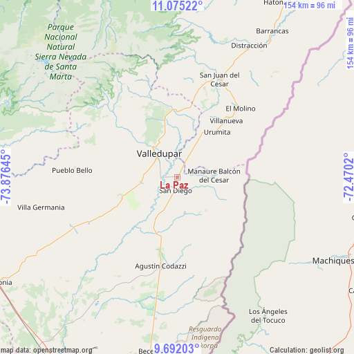
La Paz GPS coordinates[2]
10° 23' 3.804" North, 73° 10' 23.952" West
| Map corner | latitude | longitude |
|---|---|---|
| Upper-left | 11.07522°, | -73.87645° |
| Center: | 10.38439°, | -73.17332° |
| Lower-right: | 9.69203°, | -72.4702° |
| Map W x H: | 153.8×153.8 km | = 95.6×95.6mi |
| max Lat: | 13.38166° ⇑5.1% North |
| La Paz: | 10.38439° |
| min Lat: | ⇓94.9% South -4.21528° |
| min Long | La Paz | max Long |
| -81.70636° | -73.17332° | -67.06996° |
| W 83.2%⇐ | ⇒16.8% E |
Elevation
Elevation of La Paz is 152 m = 499 ft, and this is 997.3 m = 3272 ft below average elevation for this country.
| Max E: |
3342 m = 10965 ft | 77.6% |
| Avg. | 1149.3 m = 3771 ft | |
| La Paz | 152 m = 499 ft | |
Min E: |
1 m = 3 ft | 22.4% |
See also: Colombia elevation on elevation.city.
Geographical zone
La Paz is located in North Torrid zone (between Equator and Tropic of Cancer). Distance of Equator is 1154.6 km =717.4 mi to South.| Distance of | km | miles | from La Paz |
|---|---|---|---|
| North Pole | 8852.4 | 5500.6 | to North |
| Arctic Circle | 6246.5 | 3881.4 | to North |
| Tropic Cancer | 1451.3 | 901.8 | to North |
| Equator | 1154.6 | 717.4 | to South |


Nearby cities:
15 places around La Paz: (largest is in red/bold)
• Agustín Codazzi
39.3 km =24.4 mi,  189°
189°
• Barrancas
75.9 km =47.2 mi,  33°
33°
• Becerril
76.5 km =47.5 mi, 188°
• Distracción
65.1 km =40.5 mi, 28°
• El Copey
90.1 km =56 mi,  253°
253°
• El Molino
40.4 km =25.1 mi,  42°
42°
• Fonseca
66.1 km =41.1 mi, 32°
• La Jagua del Pilar
17.9 km =11.1 mi, 38°
• Manaure Balcón del Cesar
15.4 km =9.6 mi,  86°
86°
• Pueblo Bello
44.7 km =27.8 mi,  274°
274°
• San Diego
5.4 km =3.4 mi, 190°
• San Juan del Cesar
46.8 km =29.1 mi,  23°
23°
• Urumita
26.2 km =16.3 mi, 42°
• Valledupar
12.4 km =7.7 mi,  315°
315°
• Villanueva
32.7 km =20.3 mi, 40°
Sources, notices
• [Note1] Compared only with cities in Colombia existing in our database
• [Src1] Map data: © OpenStreetMap contributors (CC-BY-SA)
• [Src2] Other city data from geonames.org with taken over terms of usage.
• [Src3] Geographical zone / Annual Mean Temperature by Robert A. Rohde @ Wikipedia
