Nariño geodata
Nariño (Cundinamarca) is a seat of a second-order administrative division; located in Colombia in America/Bogota (GMT-5) time zone. With population of 1,213 people, there are 913 cities with bigger population in this country. Compared to other cities in Colombia, 73% of cities are located further ↑North; 50% of cities are located further ←West and 71.5% of cities have higher elevation than Nariño. Note1


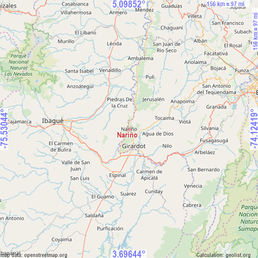
Nariño GPS coordinates[2]
4° 23' 52.116" North, 74° 49' 38.316" West
| Map corner | latitude | longitude |
|---|---|---|
| Upper-left | 5.09852°, | -75.53044° |
| Center: | 4.39781°, | -74.82731° |
| Lower-right: | 3.69644°, | -74.12419° |
| Map W x H: | 155.9×155.9 km | = 96.9×96.9mi |
| max Lat: | 13.38166° ⇑73% North |
| Nariño: | 4.39781° |
| min Lat: | ⇓27% South -4.21528° |
| min Long | Nariño | max Long |
| -81.70636° | -74.82731° | -67.06996° |
| W 50%⇐ | ⇒50% E |
Elevation
Elevation of Nariño is 264 m = 866 ft, and this is 885.3 m = 2905 ft below average elevation for this country.
| Max E: |
3342 m = 10965 ft | 71.5% |
| Avg. | 1149.3 m = 3771 ft | |
| Nariño | 264 m = 866 ft | |
Min E: |
1 m = 3 ft | 28.5% |
See also: Colombia elevation on elevation.city.
Geographical zone
Nariño is located in North Torrid zone (between Equator and Tropic of Cancer). Distance of Equator is 489 km =303.9 mi to South.| Distance of | km | miles | from Nariño |
|---|---|---|---|
| North Pole | 9518.1 | 5914.3 | to North |
| Arctic Circle | 6912.2 | 4295 | to North |
| Tropic Cancer | 2116.9 | 1315.4 | to North |
| Equator | 489 | 303.9 | to South |


Nearby cities:
15 places around Nariño: (largest is in red/bold)
• Agua de Dios
17.6 km =10.9 mi,  97°
97°
• Alvarado
23.5 km =14.6 mi,  323°
323°
• Apulo
29.3 km =18.2 mi,  62°
62°
• Chicoral
26.6 km =16.5 mi,  220°
220°
• Coello
14.4 km =8.9 mi,  213°
213°
• Doima
16.7 km =10.4 mi,  281°
281°
• Espinal
28.4 km =17.6 mi,  192°
192°
• Flandes
12 km =7.5 mi,  174°
174°
• Girardot City
11 km =6.8 mi, 168°
• Guataquí
13.8 km =8.6 mi,  17°
17°
• Jerusalén
23.5 km =14.6 mi,  38°
38°
• Nilo
25.1 km =15.6 mi,  114°
114°
• Piedras
17.1 km =10.6 mi,  340°
340°
• Ricaurte
14.8 km =9.2 mi,  151°
151°
• Tocaima
22.4 km =13.9 mi,  72°
72°
Sources, notices
• [Note1] Compared only with cities in Colombia existing in our database
• [Src1] Map data: © OpenStreetMap contributors (CC-BY-SA)
• [Src2] Other city data from geonames.org with taken over terms of usage.
• [Src3] Geographical zone / Annual Mean Temperature by Robert A. Rohde @ Wikipedia
