Flandes geodata
Flandes (Tolima) is a populated place; located in Colombia in America/Bogota (GMT-5) time zone. With population of 20,919 people, there are 169 cities with bigger population in this country. Compared to other cities in Colombia, 74.9% of cities are located further ↑North; 50.2% of cities are located further ←West and 70.5% of cities have higher elevation than Flandes. Note1


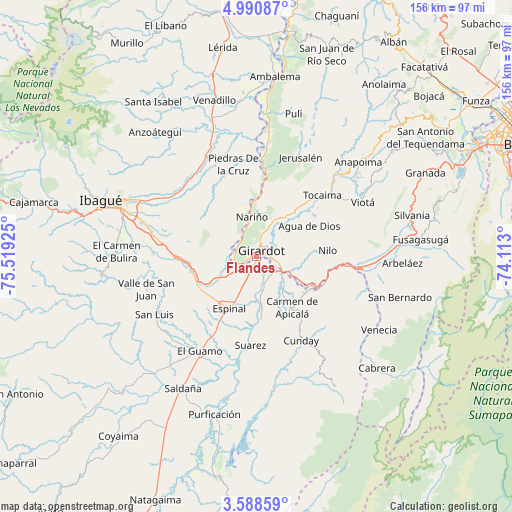
Flandes GPS coordinates[2]
4° 17' 24.18" North, 74° 48' 58.032" West
| Map corner | latitude | longitude |
|---|---|---|
| Upper-left | 4.99087°, | -75.51925° |
| Center: | 4.29005°, | -74.81612° |
| Lower-right: | 3.58859°, | -74.113° |
| Map W x H: | 155.9×155.9 km | = 96.9×96.9mi |
| max Lat: | 13.38166° ⇑74.9% North |
| Flandes: | 4.29005° |
| min Lat: | ⇓25.1% South -4.21528° |
| min Long | Flandes | max Long |
| -81.70636° | -74.81612° | -67.06996° |
| W 50.2%⇐ | ⇒49.8% E |
Elevation
Elevation of Flandes is 285 m = 935 ft, and this is 864.3 m = 2836 ft below average elevation for this country.
| Max E: |
3342 m = 10965 ft | 70.5% |
| Avg. | 1149.3 m = 3771 ft | |
| Flandes | 285 m = 935 ft | |
Min E: |
1 m = 3 ft | 29.5% |
See also: Colombia elevation on elevation.city.
Geographical zone
Flandes is located in North Torrid zone (between Equator and Tropic of Cancer). Distance of Equator is 477 km =296.4 mi to South.| Distance of | km | miles | from Flandes |
|---|---|---|---|
| North Pole | 9530.1 | 5921.7 | to North |
| Arctic Circle | 6924.2 | 4302.5 | to North |
| Tropic Cancer | 2128.9 | 1322.8 | to North |
| Equator | 477 | 296.4 | to South |


Nearby cities:
15 places around Flandes: (largest is in red/bold)
• Agua de Dios
18.8 km =11.7 mi,  59°
59°
• Carmen de Apicalá
19.1 km =11.9 mi,  146°
146°
• Chicoral
20.2 km =12.6 mi,  245°
245°
• Coello
9.1 km =5.7 mi,  269°
269°
• Doima
23.3 km =14.5 mi,  310°
310°
• Espinal
17.4 km =10.8 mi,  205°
205°
• Girardot City
1.5 km =0.9 mi,  38°
38°
• Guataquí
25.3 km =15.7 mi,  6°
6°
• Melgar
21.6 km =13.4 mi,  116°
116°
• Nariño
12 km =7.5 mi,  354°
354°
• Nilo
21.7 km =13.5 mi,  85°
85°
• Piedras
28.9 km =18 mi, 346°
• Ricaurte
5.8 km =3.6 mi,  100°
100°
• Suárez
26.9 km =16.7 mi,  183°
183°
• Tocaima
27.5 km =17.1 mi,  47°
47°
Sources, notices
• [Note1] Compared only with cities in Colombia existing in our database
• [Src1] Map data: © OpenStreetMap contributors (CC-BY-SA)
• [Src2] Other city data from geonames.org with taken over terms of usage.
• [Src3] Geographical zone / Annual Mean Temperature by Robert A. Rohde @ Wikipedia
