Filandia geodata
Filandia (Quindío) is a seat of a second-order administrative division; located in Colombia in America/Bogota (GMT-5) time zone. With population of 6,851 people, there are 414 cities with bigger population in this country. Compared to other cities in Colombia, 68.8% of cities are located further ↑North; 70.9% of cities are located further →East and 77% of cities have lower elevation than Filandia. Note1


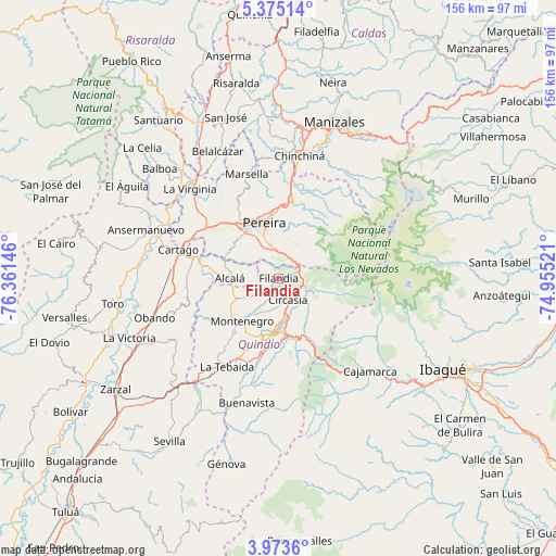
Filandia GPS coordinates[2]
4° 40' 28.992" North, 75° 39' 29.988" West
| Map corner | latitude | longitude |
|---|---|---|
| Upper-left | 5.37514°, | -76.36146° |
| Center: | 4.67472°, | -75.65833° |
| Lower-right: | 3.9736°, | -74.95521° |
| Map W x H: | 155.8×155.8 km | = 96.8×96.8mi |
| max Lat: | 13.38166° ⇑68.8% North |
| Filandia: | 4.67472° |
| min Lat: | ⇓31.2% South -4.21528° |
| min Long | Filandia | max Long |
| -81.70636° | -75.65833° | -67.06996° |
| W 29.1%⇐ | ⇒70.9% E |
Elevation
Elevation of Filandia is 1919 m = 6296 ft, and this is 769.7 m = 2525 ft above average elevation for this country.
| Max E: |
3342 m = 10965 ft | 23% |
| Filandia | 1919 m 6296 ft | |
| Avg. | 1149.3 m = 3771 ft | |
Min E: |
1 m = 3 ft | 77% |
See also: Colombia elevation on elevation.city.
Geographical zone
Filandia is located in North Torrid zone (between Equator and Tropic of Cancer). Distance of Equator is 519.8 km =323 mi to South.| Distance of | km | miles | from Filandia |
|---|---|---|---|
| North Pole | 9487.3 | 5895.1 | to North |
| Arctic Circle | 6881.4 | 4275.9 | to North |
| Tropic Cancer | 2086.1 | 1296.2 | to North |
| Equator | 519.8 | 323 | to South |


Nearby cities:
15 places around Filandia: (largest is in red/bold)
• Alcalá
13.8 km =8.6 mi,  270°
270°
• Armenia
15.9 km =9.9 mi,  189°
189°
• Calarcá
16.3 km =10.1 mi,  173°
173°
• Cartago
29.2 km =18.1 mi,  285°
285°
• Circasia
6.7 km =4.2 mi,  158°
158°
• Córdoba
31.6 km =19.6 mi, 185°
• Dosquebradas
18.3 km =11.4 mi,  356°
356°
• La Tebaida
28.5 km =17.7 mi,  210°
210°
• Marsella
30.5 km =19 mi,  343°
343°
• Montenegro
15.8 km =9.8 mi,  220°
220°
• Pereira
16 km =9.9 mi, 344°
• Quimbaya
12.9 km =8 mi,  243°
243°
• Salento
10.6 km =6.6 mi,  112°
112°
• Santa Rosa de Cabal
21.9 km =13.6 mi,  10°
10°
• Ulloa
9.7 km =6 mi, 289°
Sources, notices
• [Note1] Compared only with cities in Colombia existing in our database
• [Src1] Map data: © OpenStreetMap contributors (CC-BY-SA)
• [Src2] Other city data from geonames.org with taken over terms of usage.
• [Src3] Geographical zone / Annual Mean Temperature by Robert A. Rohde @ Wikipedia
