Chinácota geodata
Chinácota (Norte de Santander) is a seat of a second-order administrative division; located in Colombia in America/Bogota (GMT-5) time zone. With population of 9,667 people, there are 318 cities with bigger population in this country. Compared to other cities in Colombia, 78.6% of cities are located further ↓South; 94.4% of cities are located further ←West and 52.7% of cities have lower elevation than Chinácota. Note1


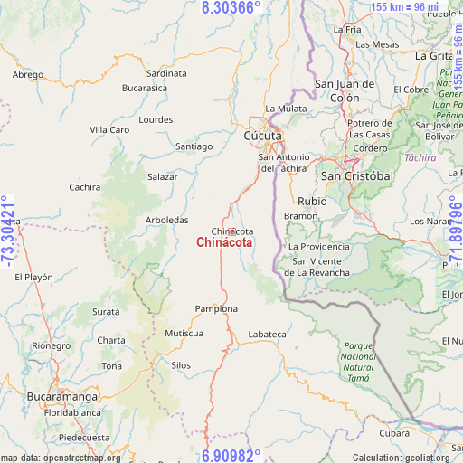
Chinácota GPS coordinates[2]
7° 36' 26.316" North, 72° 36' 3.888" West
| Map corner | latitude | longitude |
|---|---|---|
| Upper-left | 8.30366°, | -73.30421° |
| Center: | 7.60731°, | -72.60108° |
| Lower-right: | 6.90982°, | -71.89796° |
| Map W x H: | 155×155 km | = 96.3×96.3mi |
| max Lat: | 13.38166° ⇑21.4% North |
| Chinácota: | 7.60731° |
| min Lat: | ⇓78.6% South -4.21528° |
| min Long | Chinácota | max Long |
| -81.70636° | -72.60108° | -67.06996° |
| W 94.4%⇐ | ⇒5.6% E |
Elevation
Elevation of Chinácota is 1232 m = 4042 ft, and this is 82.7 m = 271 ft above average elevation for this country.
| Max E: |
3342 m = 10965 ft | 47.3% |
| Chinácota | 1232 m 4042 ft | |
| Avg. | 1149.3 m = 3771 ft | |
Min E: |
1 m = 3 ft | 52.7% |
See also: Colombia elevation on elevation.city.
Geographical zone
Chinácota is located in North Torrid zone (between Equator and Tropic of Cancer). Distance of Equator is 845.9 km =525.6 mi to South.| Distance of | km | miles | from Chinácota |
|---|---|---|---|
| North Pole | 9161.2 | 5692.5 | to North |
| Arctic Circle | 6555.3 | 4073.3 | to North |
| Tropic Cancer | 1760.1 | 1093.7 | to North |
| Equator | 845.9 | 525.6 | to South |


Nearby cities:
15 places around Chinácota: (largest is in red/bold)
• Arboledas
22.2 km =13.8 mi,  280°
280°
• Bochalema
5.2 km =3.2 mi,  274°
274°
• Cucutilla
20.3 km =12.6 mi,  248°
248°
• Cúcuta
33.5 km =20.8 mi,  17°
17°
• Durania
13.3 km =8.3 mi,  332°
332°
• Herrán
17.2 km =10.7 mi,  130°
130°
• Labateca
36.2 km =22.5 mi,  161°
161°
• Los Patios
27.8 km =17.3 mi, 22°
• Pamplona
26.3 km =16.3 mi,  191°
191°
• Pamplonita
19.4 km =12.1 mi, 192°
• Ragonvalia
14.2 km =8.8 mi,  103°
103°
• San Cayetano
30.1 km =18.7 mi,  355°
355°
• Santiago
31.3 km =19.4 mi,  336°
336°
• Toledo
35.5 km =22.1 mi, 158°
• Villa del Rosario
28.8 km =17.9 mi,  29°
29°
Sources, notices
• [Note1] Compared only with cities in Colombia existing in our database
• [Src1] Map data: © OpenStreetMap contributors (CC-BY-SA)
• [Src2] Other city data from geonames.org with taken over terms of usage.
• [Src3] Geographical zone / Annual Mean Temperature by Robert A. Rohde @ Wikipedia
