Ragonvalia geodata
Ragonvalia (Norte de Santander) is a seat of a second-order administrative division; located in Colombia in America/Bogota (GMT-5) time zone. With population of 3,543 people, there are 625 cities with bigger population in this country. Compared to other cities in Colombia, 78.3% of cities are located further ↓South; 96.1% of cities are located further ←West and 63% of cities have lower elevation than Ragonvalia. Note1


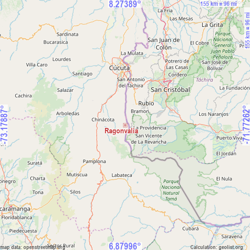
Ragonvalia GPS coordinates[2]
7° 34' 38.964" North, 72° 28' 32.664" West
| Map corner | latitude | longitude |
|---|---|---|
| Upper-left | 8.27389°, | -73.17887° |
| Center: | 7.57749°, | -72.47574° |
| Lower-right: | 6.87996°, | -71.77262° |
| Map W x H: | 155×155 km | = 96.3×96.3mi |
| max Lat: | 13.38166° ⇑21.7% North |
| Ragonvalia: | 7.57749° |
| min Lat: | ⇓78.3% South -4.21528° |
| min Long | Ragonvalia | max Long |
| -81.70636° | -72.47574° | -67.06996° |
| W 96.1%⇐ | ⇒3.9% E |
Elevation
Elevation of Ragonvalia is 1546 m = 5072 ft, and this is 396.7 m = 1302 ft above average elevation for this country.
| Max E: |
3342 m = 10965 ft | 37% |
| Ragonvalia | 1546 m 5072 ft | |
| Avg. | 1149.3 m = 3771 ft | |
Min E: |
1 m = 3 ft | 63% |
See also: Colombia elevation on elevation.city.
Geographical zone
Ragonvalia is located in North Torrid zone (between Equator and Tropic of Cancer). Distance of Equator is 842.5 km =523.5 mi to South.| Distance of | km | miles | from Ragonvalia |
|---|---|---|---|
| North Pole | 9164.5 | 5694.6 | to North |
| Arctic Circle | 6558.6 | 4075.3 | to North |
| Tropic Cancer | 1763.4 | 1095.7 | to North |
| Equator | 842.5 | 523.5 | to South |


Nearby cities:
15 places around Ragonvalia: (largest is in red/bold)
• Arboledas
36.4 km =22.6 mi,  281°
281°
• Bochalema
19.3 km =12 mi, 281°
• Chinácota
14.2 km =8.8 mi, 283°
• Cucutilla
33 km =20.5 mi,  262°
262°
• Cácota
39 km =24.2 mi,  208°
208°
• Cúcuta
35.4 km =22 mi,  354°
354°
• Durania
25.1 km =15.6 mi,  306°
306°
• Herrán
8 km =5 mi,  186°
186°
• Labateca
31 km =19.3 mi,  183°
183°
• Los Patios
29.1 km =18.1 mi, 353°
• Pamplona
29.4 km =18.3 mi,  220°
220°
• Pamplonita
23.8 km =14.8 mi,  228°
228°
• San Cayetano
37.1 km =23.1 mi,  333°
333°
• Toledo
29.8 km =18.5 mi, 181°
• Villa del Rosario
28.5 km =17.7 mi,  0°
0°
Sources, notices
• [Note1] Compared only with cities in Colombia existing in our database
• [Src1] Map data: © OpenStreetMap contributors (CC-BY-SA)
• [Src2] Other city data from geonames.org with taken over terms of usage.
• [Src3] Geographical zone / Annual Mean Temperature by Robert A. Rohde @ Wikipedia
