Valle del Guamuez geodata
Valle del Guamuez (Putumayo) is a populated place; located in Colombia in America/Bogota (GMT-5) time zone. With population of 9,969 people, there are 306 cities with bigger population in this country. Compared to other cities in Colombia, 99.5% of cities are located further ↑North; 91.6% of cities are located further →East and 68% of cities have higher elevation than Valle del Guamuez. Note1


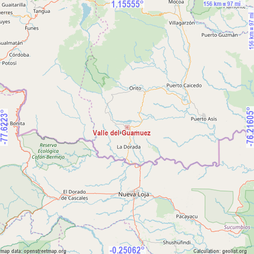
Valle del Guamuez GPS coordinates[2]
0° 27' 9" North, 76° 55' 9.012" West
| Map corner | latitude | longitude |
|---|---|---|
| Upper-left | 1.15555°, | -77.6223° |
| Center: | 0.4525°, | -76.91917° |
| Lower-right: | -0.25062°, | -76.21605° |
| Map W x H: | 156.4×156.4 km | = 97.2×97.2mi |
| max Lat: | 13.38166° ⇑99.5% North |
| Valle del Guamuez: | 0.4525° |
| min Lat: | ⇓0.5% South -4.21528° |
| min Long | Valle del Guamu | max Long |
| -81.70636° | -76.91917° | -67.06996° |
| W 8.4%⇐ | ⇒91.6% E |
Elevation
Elevation of Valle del Guamuez is 336 m = 1102 ft, and this is 813.3 m = 2668 ft below average elevation for this country.
| Max E: |
3342 m = 10965 ft | 68% |
| Avg. | 1149.3 m = 3771 ft | |
| Valle del Guamuez | 336 m = 1102 ft | |
Min E: |
1 m = 3 ft | 32% |
See also: Colombia elevation on elevation.city.
Geographical zone
Valle del Guamuez is located in North Torrid zone (between Equator and Tropic of Cancer). Distance of Equator is 50.3 km =31.3 mi to South.| Distance of | km | miles | from Valle del Guamuez |
|---|---|---|---|
| North Pole | 9956.7 | 6186.8 | to North |
| Arctic Circle | 7350.9 | 4567.6 | to North |
| Tropic Cancer | 2555.6 | 1588 | to North |
| Equator | 50.3 | 31.3 | to South |


Nearby cities:
15 places around Valle del Guamuez: (largest is in red/bold)
• Colón
82.3 km =51.1 mi,  355°
355°
• Córdoba
80.2 km =49.8 mi,  303°
303°
• La Dorada
12.2 km =7.6 mi,  175°
175°
• La Hormiga
3.3 km =2.1 mi,  153°
153°
• Mocoa
83.3 km =51.8 mi,  20°
20°
• Orito
24.5 km =15.2 mi,  12°
12°
• Potosí
82.6 km =51.3 mi, 298°
• Puerres
80.7 km =50.1 mi,  306°
306°
• Puerto Asís
47.4 km =29.5 mi,  82°
82°
• Puerto Caicedo
43.4 km =27 mi,  53°
53°
• Puerto Guzmán
68.5 km =42.6 mi,  32°
32°
• Puerto Guzmán
80.4 km =50 mi,  44°
44°
• San Francisco
80.6 km =50.1 mi,  3°
3°
• Santiago
78 km =48.5 mi,  353°
353°
• Villagarzón
72.7 km =45.2 mi, 26°
Sources, notices
• [Note1] Compared only with cities in Colombia existing in our database
• [Src1] Map data: © OpenStreetMap contributors (CC-BY-SA)
• [Src2] Other city data from geonames.org with taken over terms of usage.
• [Src3] Geographical zone / Annual Mean Temperature by Robert A. Rohde @ Wikipedia
