Armero-Guyabal geodata
Armero-Guyabal (Tolima) is a populated locality; located in Colombia in America/Bogota (GMT-5) time zone. With population of 11,720 people, there are 260 cities with bigger population in this country. Compared to other cities in Colombia, 63% of cities are located further ↑North; 51.8% of cities are located further →East and 67.7% of cities have higher elevation than Armero-Guyabal. Note1


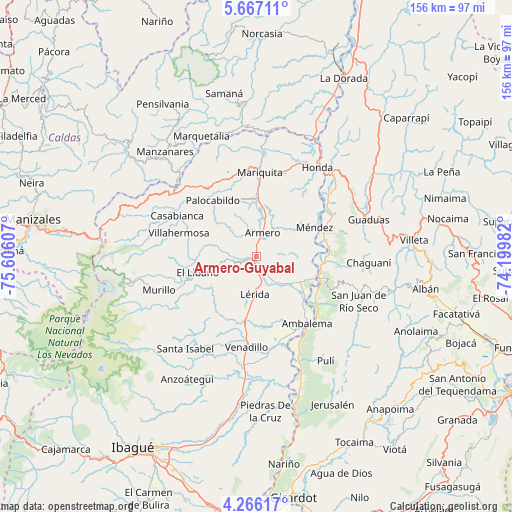
Armero-Guyabal GPS coordinates[2]
4° 58' 1.236" North, 74° 54' 10.584" West
| Map corner | latitude | longitude |
|---|---|---|
| Upper-left | 5.66711°, | -75.60607° |
| Center: | 4.96701°, | -74.90294° |
| Lower-right: | 4.26617°, | -74.19982° |
| Map W x H: | 155.8×155.8 km | = 96.8×96.8mi |
| max Lat: | 13.38166° ⇑63% North |
| Armero-Guyabal: | 4.96701° |
| min Lat: | ⇓37% South -4.21528° |
| min Long | Armero-Guyabal | max Long |
| -81.70636° | -74.90294° | -67.06996° |
| W 48.2%⇐ | ⇒51.8% E |
Elevation
Elevation of Armero-Guyabal is 341 m = 1119 ft, and this is 808.3 m = 2652 ft below average elevation for this country.
| Max E: |
3342 m = 10965 ft | 67.7% |
| Avg. | 1149.3 m = 3771 ft | |
| Armero-Guyabal | 341 m = 1119 ft | |
Min E: |
1 m = 3 ft | 32.3% |
See also: Colombia elevation on elevation.city.
Geographical zone
Armero-Guyabal is located in North Torrid zone (between Equator and Tropic of Cancer). Distance of Equator is 552.3 km =343.2 mi to South.| Distance of | km | miles | from Armero-Guyabal |
|---|---|---|---|
| North Pole | 9454.8 | 5874.9 | to North |
| Arctic Circle | 6848.9 | 4255.7 | to North |
| Tropic Cancer | 2053.6 | 1276 | to North |
| Equator | 552.3 | 343.2 | to South |


Nearby cities:
15 places around Armero-Guyabal: (largest is in red/bold)
• Ambalema
25.6 km =15.9 mi,  142°
142°
• Beltrán
25.6 km =15.9 mi, 135°
• Casabianca
27.2 km =16.9 mi,  297°
297°
• Falan
18.3 km =11.4 mi,  342°
342°
• Fresno
25.4 km =15.8 mi,  324°
324°
• Frías
13.6 km =8.5 mi, 300°
• Guayabal
7.3 km =4.5 mi,  14°
14°
• Junín
24 km =14.9 mi,  211°
211°
• Lérida
11.7 km =7.3 mi,  183°
183°
• Líbano
18.4 km =11.4 mi,  254°
254°
• Murillo
31.5 km =19.6 mi, 250°
• Palocabildo
20.9 km =13 mi, 322°
• San Sebastián de Mariquita
25.8 km =16 mi,  2°
2°
• Venadillo
27.7 km =17.2 mi,  186°
186°
• Villahermosa
24.6 km =15.3 mi,  286°
286°
Sources, notices
• [Note1] Compared only with cities in Colombia existing in our database
• [Src1] Map data: © OpenStreetMap contributors (CC-BY-SA)
• [Src2] Other city data from geonames.org with taken over terms of usage.
• [Src3] Geographical zone / Annual Mean Temperature by Robert A. Rohde @ Wikipedia
