Murillo geodata
Murillo (Tolima) is a seat of a second-order administrative division; located in Colombia in America/Bogota (GMT-5) time zone. With population of 1,860 people, there are 820 cities with bigger population in this country. Compared to other cities in Colombia, 64.8% of cities are located further ↑North; 58.7% of cities are located further →East and 98.8% of cities have lower elevation than Murillo. Note1


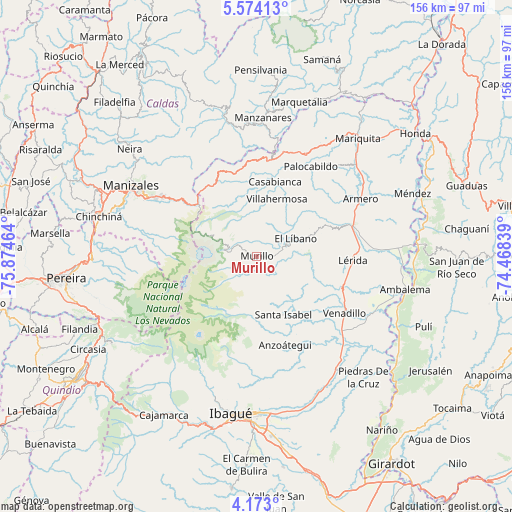
Murillo GPS coordinates[2]
4° 52' 26.148" North, 75° 10' 17.436" West
| Map corner | latitude | longitude |
|---|---|---|
| Upper-left | 5.57413°, | -75.87464° |
| Center: | 4.87393°, | -75.17151° |
| Lower-right: | 4.173°, | -74.46839° |
| Map W x H: | 155.8×155.8 km | = 96.8×96.8mi |
| max Lat: | 13.38166° ⇑64.8% North |
| Murillo: | 4.87393° |
| min Lat: | ⇓35.2% South -4.21528° |
| min Long | Murillo | max Long |
| -81.70636° | -75.17151° | -67.06996° |
| W 41.3%⇐ | ⇒58.7% E |
Elevation
Elevation of Murillo is 2986 m = 9797 ft, and this is 1836.7 m = 6026 ft above average elevation for this country.
| Max E: |
3342 m = 10965 ft | 1.2% |
| Murillo | 2986 m 9797 ft | |
| Avg. | 1149.3 m = 3771 ft | |
Min E: |
1 m = 3 ft | 98.8% |
See also: Colombia elevation on elevation.city.
Geographical zone
Murillo is located in North Torrid zone (between Equator and Tropic of Cancer). Distance of Equator is 541.9 km =336.7 mi to South.| Distance of | km | miles | from Murillo |
|---|---|---|---|
| North Pole | 9465.1 | 5881.3 | to North |
| Arctic Circle | 6859.2 | 4262.1 | to North |
| Tropic Cancer | 2064 | 1282.5 | to North |
| Equator | 541.9 | 336.7 | to South |


Nearby cities:
15 places around Murillo: (largest is in red/bold)
• Anzoátegui
28.3 km =17.6 mi,  162°
162°
• Armero-Guyabal
31.5 km =19.6 mi,  70°
70°
• Casabianca
23.6 km =14.7 mi,  13°
13°
• Fresno
34.4 km =21.4 mi,  25°
25°
• Frías
25 km =15.5 mi,  46°
46°
• Guayabal
36 km =22.4 mi,  61°
61°
• Herveo
22.9 km =14.2 mi,  358°
358°
• Junín
19.9 km =12.4 mi,  120°
120°
• Lérida
29 km =18 mi,  92°
92°
• Líbano
13.2 km =8.2 mi, 66°
• Padua
29.2 km =18.1 mi, 6°
• Palocabildo
32 km =19.9 mi, 32°
• Santa Isabel
19.5 km =12.1 mi, 155°
• Venadillo
31.9 km =19.8 mi, 122°
• Villahermosa
18.5 km =11.5 mi,  19°
19°
Sources, notices
• [Note1] Compared only with cities in Colombia existing in our database
• [Src1] Map data: © OpenStreetMap contributors (CC-BY-SA)
• [Src2] Other city data from geonames.org with taken over terms of usage.
• [Src3] Geographical zone / Annual Mean Temperature by Robert A. Rohde @ Wikipedia
