Líbano geodata
Líbano (Tolima) is a seat of a second-order administrative division; located in Colombia in America/Bogota (GMT-5) time zone. With population of 28,211 people, there are 128 cities with bigger population in this country. Compared to other cities in Colombia, 63.9% of cities are located further ↑North; 55.4% of cities are located further →East and 63.9% of cities have lower elevation than Líbano. Note1


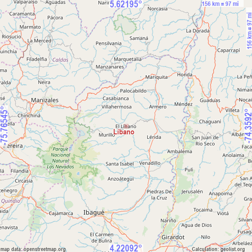
Líbano GPS coordinates[2]
4° 55' 18.48" North, 75° 3' 44.352" West
| Map corner | latitude | longitude |
|---|---|---|
| Upper-left | 5.62195°, | -75.76545° |
| Center: | 4.9218°, | -75.06232° |
| Lower-right: | 4.22092°, | -74.3592° |
| Map W x H: | 155.8×155.8 km | = 96.8×96.8mi |
| max Lat: | 13.38166° ⇑63.9% North |
| Líbano: | 4.9218° |
| min Lat: | ⇓36.1% South -4.21528° |
| min Long | Líbano | max Long |
| -81.70636° | -75.06232° | -67.06996° |
| W 44.6%⇐ | ⇒55.4% E |
Elevation
Elevation of Líbano is 1575 m = 5167 ft, and this is 425.7 m = 1397 ft above average elevation for this country.
| Max E: |
3342 m = 10965 ft | 36.1% |
| Líbano | 1575 m 5167 ft | |
| Avg. | 1149.3 m = 3771 ft | |
Min E: |
1 m = 3 ft | 63.9% |
See also: Colombia elevation on elevation.city.
Geographical zone
Líbano is located in North Torrid zone (between Equator and Tropic of Cancer). Distance of Equator is 547.3 km =340.1 mi to South.| Distance of | km | miles | from Líbano |
|---|---|---|---|
| North Pole | 9459.8 | 5878 | to North |
| Arctic Circle | 6853.9 | 4258.8 | to North |
| Tropic Cancer | 2058.7 | 1279.2 | to North |
| Equator | 547.3 | 340.1 | to South |


Nearby cities:
15 places around Líbano: (largest is in red/bold)
• Armero-Guyabal
18.4 km =11.4 mi,  74°
74°
• Casabianca
18.7 km =11.6 mi,  339°
339°
• Falan
25.6 km =15.9 mi,  28°
28°
• Fresno
25.8 km =16 mi,  6°
6°
• Frías
13.4 km =8.3 mi, 26°
• Guayabal
22.9 km =14.2 mi,  58°
58°
• Herveo
21.6 km =13.4 mi,  324°
324°
• Junín
16.2 km =10.1 mi,  161°
161°
• Lérida
18.1 km =11.2 mi,  111°
111°
• Murillo
13.2 km =8.2 mi,  246°
246°
• Padua
25.1 km =15.6 mi, 339°
• Palocabildo
22.3 km =13.9 mi, 12°
• Santa Isabel
23.4 km =14.5 mi,  189°
189°
• Venadillo
26.9 km =16.7 mi,  146°
146°
• Villahermosa
13.5 km =8.4 mi,  333°
333°
Sources, notices
• [Note1] Compared only with cities in Colombia existing in our database
• [Src1] Map data: © OpenStreetMap contributors (CC-BY-SA)
• [Src2] Other city data from geonames.org with taken over terms of usage.
• [Src3] Geographical zone / Annual Mean Temperature by Robert A. Rohde @ Wikipedia
