San Rafael geodata
San Rafael (San José) is a populated place; located in Costa Rica in America/Costa_Rica (GMT-6) time zone. With population of 25,410 people, there are 25 cities with bigger population in this country. Compared to other cities in Costa Rica, 61.2% of cities are located further ↑North; 52.2% of cities are located further →East and 61.2% of cities have lower elevation than San Rafael. Note1


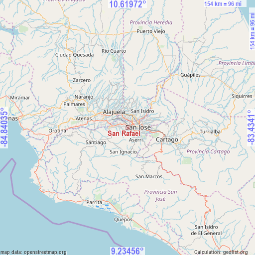
San Rafael GPS coordinates[2]
9° 55' 40.332" North, 84° 8' 13.992" West
| Map corner | latitude | longitude |
|---|---|---|
| Upper-left | 10.61972°, | -84.84035° |
| Center: | 9.92787°, | -84.13722° |
| Lower-right: | 9.23456°, | -83.4341° |
| Map W x H: | 154×154 km | = 95.7×95.7mi |
| max Lat: | 11.07377° ⇑61.2% North |
| San Rafael: | 9.92787° |
| min Lat: | ⇓38.8% South 8.53305° |
| min Long | San Rafael | max Long |
| -85.64748° | -84.13722° | -82.62185° |
| W 47.8%⇐ | ⇒52.2% E |
Elevation
Elevation of San Rafael is 1060 m = 3478 ft, and this is 325 m = 1066 ft above average elevation for this country.
| Max E: |
1844 m = 6050 ft | 38.8% |
| San Rafael | 1060 m 3478 ft | |
| Avg. | 735 m = 2411 ft | |
Min E: |
7 m = 23 ft | 61.2% |
See also: Costa Rica elevation on elevation.city.
Geographical zone
San Rafael is located in North Torrid zone (between Equator and Tropic of Cancer). Distance of Equator is 1103.9 km =685.9 mi to South.| Distance of | km | miles | from San Rafael |
|---|---|---|---|
| North Pole | 8903.2 | 5532.2 | to North |
| Arctic Circle | 6297.3 | 3913 | to North |
| Tropic Cancer | 1502 | 933.3 | to North |
| Equator | 1103.9 | 685.9 | to South |


Nearby cities:
15 places around San Rafael: (largest is in red/bold)
• Alajuelita
5 km =3.1 mi,  125°
125°
• Calle Blancos
8.1 km =5 mi,  72°
72°
• Colima
6.3 km =3.9 mi, 65°
• Escazú
1 km =0.6 mi,  196°
196°
• Heredia
8.6 km =5.3 mi,  15°
15°
• La Asunción
6.9 km =4.3 mi,  325°
325°
• Llorente
8.1 km =5 mi,  346°
346°
• Salitral
4.9 km =3 mi,  248°
248°
• San Antonio
8 km =5 mi,  320°
320°
• San Felipe
4.3 km =2.7 mi, 126°
• San Francisco
7.3 km =4.5 mi,  6°
6°
• San José
5.9 km =3.7 mi,  84°
84°
• San Juan
7 km =4.3 mi,  59°
59°
• San Juan de Dios
8 km =5 mi, 134°
• Santa Ana
5 km =3.1 mi,  276°
276°
Sources, notices
• [Note1] Compared only with cities in Costa Rica existing in our database
• [Src1] Map data: © OpenStreetMap contributors (CC-BY-SA)
• [Src2] Other city data from geonames.org with taken over terms of usage.
• [Src3] Geographical zone / Annual Mean Temperature by Robert A. Rohde @ Wikipedia
