San Antonio geodata
San Antonio (Heredia) is a populated place; located in Costa Rica in America/Costa_Rica (GMT-6) time zone. With population of 10,938 people, there are 51 cities with bigger population in this country. Compared to other cities in Costa Rica, 53.7% of cities are located further ↓South; 59% of cities are located further →East and 52.2% of cities have lower elevation than San Antonio. Note1


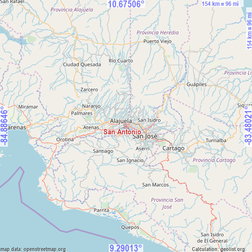
San Antonio GPS coordinates[2]
9° 58' 59.988" North, 84° 10' 59.988" West
| Map corner | latitude | longitude |
|---|---|---|
| Upper-left | 10.67506°, | -84.88646° |
| Center: | 9.98333°, | -84.18333° |
| Lower-right: | 9.29013°, | -83.48021° |
| Map W x H: | 154×154 km | = 95.7×95.7mi |
| max Lat: | 11.07377° ⇑46.3% North |
| San Antonio: | 9.98333° |
| min Lat: | ⇓53.7% South 8.53305° |
| min Long | San Antonio | max Long |
| -85.64748° | -84.18333° | -82.62185° |
| W 41%⇐ | ⇒59% E |
Elevation
Elevation of San Antonio is 937 m = 3074 ft, and this is 202 m = 663 ft above average elevation for this country.
| Max E: |
1844 m = 6050 ft | 47.8% |
| San Antonio | 937 m 3074 ft | |
| Avg. | 735 m = 2411 ft | |
Min E: |
7 m = 23 ft | 52.2% |
See also: Costa Rica elevation on elevation.city.
Geographical zone
San Antonio is located in North Torrid zone (between Equator and Tropic of Cancer). Distance of Equator is 1110 km =689.7 mi to South.| Distance of | km | miles | from San Antonio |
|---|---|---|---|
| North Pole | 8897 | 5528.3 | to North |
| Arctic Circle | 6291.1 | 3909.1 | to North |
| Tropic Cancer | 1495.9 | 929.5 | to North |
| Equator | 1110 | 689.7 | to South |


Nearby cities:
15 places around San Antonio: (largest is in red/bold)
• Alajuela
4.8 km =3 mi,  319°
319°
• Colón
9.9 km =6.2 mi,  220°
220°
• Escazú
8.6 km =5.3 mi,  146°
146°
• Heredia
7.6 km =4.7 mi,  73°
73°
• La Asunción
1.2 km =0.7 mi,  109°
109°
• Llorente
3.6 km =2.2 mi,  61°
61°
• Mercedes
6 km =3.7 mi, 64°
• Salitral
8 km =5 mi,  176°
176°
• San Francisco
6 km =3.7 mi,  79°
79°
• San Josecito
9.8 km =6.1 mi, 67°
• San Pablo
9.6 km =6 mi, 81°
• San Rafael
8 km =5 mi,  140°
140°
• San Rafael
9.7 km =6 mi, 69°
• Santa Ana
5.6 km =3.5 mi, 179°
• Santo Domingo
9.5 km =5.9 mi,  19°
19°
Sources, notices
• [Note1] Compared only with cities in Costa Rica existing in our database
• [Src1] Map data: © OpenStreetMap contributors (CC-BY-SA)
• [Src2] Other city data from geonames.org with taken over terms of usage.
• [Src3] Geographical zone / Annual Mean Temperature by Robert A. Rohde @ Wikipedia
