Topes de Collantes geodata
Topes de Collantes (Sancti Spíritus) is a populated place; located in Cuba in America/Havana (GMT-4) time zone. With population of 9,729 people, there are 140 cities with bigger population in this country. Compared to other cities in Cuba, 60.8% of cities are located further ↑North; 52.5% of cities are located further →East and 100% of cities have lower elevation than Topes de Collantes. Note1


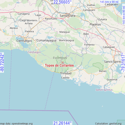
Topes de Collantes GPS coordinates[2]
21° 54' 54.864" North, 80° 1' 9.444" West
| Map corner | latitude | longitude |
|---|---|---|
| Upper-left | 22.56605°, | -80.72242° |
| Center: | 21.91524°, | -80.01929° |
| Lower-right: | 21.26144°, | -79.31617° |
| Map W x H: | 145.1×145.1 km | = 90.2×90.2mi |
| max Lat: | 23.15917° ⇑60.8% North |
| Topes de Collantes: | 21.91524° |
| min Lat: | ⇓39.2% South 19.90553° |
| min Long | Topes de Collan | max Long |
| -84.28599° | -80.01929° | -74.15181° |
| W 47.5%⇐ | ⇒52.5% E |
Elevation
Elevation of Topes de Collantes is 761 m = 2497 ft, and this is 692.4 m = 2272 ft above average elevation for this country.
| Max E: |
761 m = 2497 ft | 0% |
| Topes de Collantes | 761 m 2497 ft | |
| Avg. | 68.6 m = 225 ft | |
Min E: |
3 m = 10 ft | 100% |
See also: Cuba elevation on elevation.city.
Geographical zone
Topes de Collantes is located in North Torrid zone (between Equator and Tropic of Cancer). Distance of this Northern Tropic circle is 169.2 km =105.1 mi to North.| Distance of | km | miles | from Topes de Collantes |
|---|---|---|---|
| North Pole | 7570.3 | 4704 | to North |
| Arctic Circle | 4964.4 | 3084.7 | to North |
| Tropic Cancer | 169.2 | 105.1 | to North |
| Equator | 2436.7 | 1514.1 | to South |


Nearby cities:
15 places around Topes de Collantes: (largest is in red/bold)
• Cabaiguán
56.8 km =35.3 mi,  71°
71°
• Cienfuegos
51.2 km =31.8 mi,  300°
300°
• Condado
19 km =11.8 mi,  103°
103°
• Cruces
54 km =33.6 mi,  331°
331°
• Cumanayagua
32.5 km =20.2 mi,  324°
324°
• Esperanza
59.6 km =37 mi,  352°
352°
• Fomento
37.2 km =23.1 mi,  55°
55°
• Guayos
59.5 km =37 mi,  75°
75°
• Manicaragua
26.5 km =16.5 mi,  9°
9°
• Palmira
52.7 km =32.7 mi,  313°
313°
• Placetas
57.9 km =36 mi,  40°
40°
• Ranchuelo
52.6 km =32.7 mi, 345°
• Sancti Spíritus
59.5 km =37 mi,  88°
88°
• Santa Clara
55 km =34.2 mi, 5°
• Trinidad
13.1 km =8.1 mi,  164°
164°
Sources, notices
• [Note1] Compared only with cities in Cuba existing in our database
• [Src1] Map data: © OpenStreetMap contributors (CC-BY-SA)
• [Src2] Other city data from geonames.org with taken over terms of usage.
• [Src3] Geographical zone / Annual Mean Temperature by Robert A. Rohde @ Wikipedia
