Soroa geodata
Soroa (Artemisa) is a populated locality; located in Cuba in America/Havana (GMT-4) time zone. With population of 7,205 people, there are 142 cities with bigger population in this country. Compared to other cities in Cuba, 76.2% of cities are located further ↓South; 92.3% of cities are located further →East and 97.8% of cities have lower elevation than Soroa. Note1


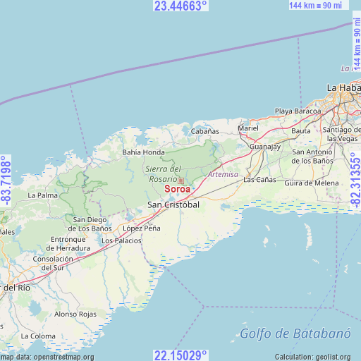
Soroa GPS coordinates[2]
22° 48' 0" North, 83° 1' 0.012" West
| Map corner | latitude | longitude |
|---|---|---|
| Upper-left | 23.44663°, | -83.7198° |
| Center: | 22.8°, | -83.01667° |
| Lower-right: | 22.15029°, | -82.31355° |
| Map W x H: | 144.1×144.1 km | = 89.5×89.5mi |
| max Lat: | 23.15917° ⇑23.8% North |
| Soroa: | 22.8° |
| min Lat: | ⇓76.2% South 19.90553° |
| min Long | Soroa | max Long |
| -84.28599° | -83.01667° | -74.15181° |
| W 7.7%⇐ | ⇒92.3% E |
Elevation
Elevation of Soroa is 226 m = 741 ft, and this is 157.4 m = 516 ft above average elevation for this country.
| Max E: |
761 m = 2497 ft | 2.2% |
| Soroa | 226 m 741 ft | |
| Avg. | 68.6 m = 225 ft | |
Min E: |
3 m = 10 ft | 97.8% |
See also: Cuba elevation on elevation.city.
Geographical zone
Soroa is located in North Torrid zone (between Equator and Tropic of Cancer). Distance of this Northern Tropic circle is 70.8 km =44 mi to North.| Distance of | km | miles | from Soroa |
|---|---|---|---|
| North Pole | 7471.9 | 4642.8 | to North |
| Arctic Circle | 4866.1 | 3023.7 | to North |
| Tropic Cancer | 70.8 | 44 | to North |
| Equator | 2535.1 | 1575.2 | to South |


Nearby cities:
15 places around Soroa: (largest is in red/bold)
• Alquízar
44.4 km =27.6 mi,  89°
89°
• Artemisa
26.4 km =16.4 mi, 85°
• Bahía Honda
18.6 km =11.6 mi,  308°
308°
• Bauta
52.2 km =32.4 mi,  67°
67°
• Cabañas
22.2 km =13.8 mi,  25°
25°
• Caimito
46.4 km =28.8 mi, 68°
• Candelaria
8.9 km =5.5 mi,  138°
138°
• Guanajay
36.5 km =22.7 mi, 67°
• Güira de Melena
52.3 km =32.5 mi, 90°
• La Palma
55.4 km =34.4 mi,  264°
264°
• Los Palacios
33.3 km =20.7 mi,  225°
225°
• Mariel
34.2 km =21.3 mi,  51°
51°
• San Antonio de los Baños
53.8 km =33.4 mi,  79°
79°
• San Cristobal
10.1 km =6.3 mi,  203°
203°
• San Diego de Los Baños
40 km =24.9 mi,  244°
244°
Sources, notices
• [Note1] Compared only with cities in Cuba existing in our database
• [Src1] Map data: © OpenStreetMap contributors (CC-BY-SA)
• [Src2] Other city data from geonames.org with taken over terms of usage.
• [Src3] Geographical zone / Annual Mean Temperature by Robert A. Rohde @ Wikipedia
