San Cristobal geodata
San Cristobal (Artemisa) is a populated place; located in Cuba in America/Havana (GMT-4) time zone. With population of 59,579 people, there are 39 cities with bigger population in this country. Compared to other cities in Cuba, 66.9% of cities are located further ↓South; 92.8% of cities are located further →East and 60.2% of cities have lower elevation than San Cristobal. Note1


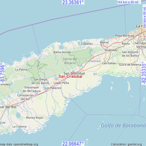
San Cristobal GPS coordinates[2]
22° 42' 59.688" North, 83° 3' 23.292" West
| Map corner | latitude | longitude |
|---|---|---|
| Upper-left | 23.36361°, | -83.7596° |
| Center: | 22.71658°, | -83.05647° |
| Lower-right: | 22.06647°, | -82.35335° |
| Map W x H: | 144.2×144.2 km | = 89.6×89.6mi |
| max Lat: | 23.15917° ⇑33.1% North |
| San Cristobal: | 22.71658° |
| min Lat: | ⇓66.9% South 19.90553° |
| min Long | San Cristobal | max Long |
| -84.28599° | -83.05647° | -74.15181° |
| W 7.2%⇐ | ⇒92.8% E |
Elevation
Elevation of San Cristobal is 63 m = 207 ft, and this is 5.6 m = 18 ft below average elevation for this country.
| Max E: |
761 m = 2497 ft | 39.8% |
| Avg. | 68.6 m = 225 ft | |
| San Cristobal | 63 m = 207 ft | |
Min E: |
3 m = 10 ft | 60.2% |
See also: San Cristobal elevation on elevation.city.
Geographical zone
San Cristobal is located in North Torrid zone (between Equator and Tropic of Cancer). Distance of this Northern Tropic circle is 80.1 km =49.8 mi to North.| Distance of | km | miles | from San Cristobal |
|---|---|---|---|
| North Pole | 7481.2 | 4648.6 | to North |
| Arctic Circle | 4875.3 | 3029.4 | to North |
| Tropic Cancer | 80.1 | 49.8 | to North |
| Equator | 2525.8 | 1569.5 | to South |


Nearby cities:
15 places around San Cristobal: (largest is in red/bold)
• Alquízar
49.4 km =30.7 mi,  78°
78°
• Artemisa
32.4 km =20.1 mi,  69°
69°
• Bahía Honda
23.3 km =14.5 mi,  332°
332°
• Bauta
60 km =37.3 mi,  60°
60°
• Cabañas
32.3 km =20.1 mi,  25°
25°
• Caimito
54 km =33.6 mi, 61°
• Candelaria
10.3 km =6.4 mi, 75°
• Consolación del Sur
52.6 km =32.7 mi,  243°
243°
• Guanajay
44.4 km =27.6 mi, 58°
• Güira de Melena
57.1 km =35.5 mi, 81°
• La Palma
51.2 km =31.8 mi,  274°
274°
• Los Palacios
24.1 km =15 mi,  233°
233°
• Mariel
43.4 km =27 mi,  45°
45°
• San Diego de Los Baños
33.1 km =20.6 mi,  256°
256°
• Soroa
10.1 km =6.3 mi,  23°
23°
Sources, notices
• [Note1] Compared only with cities in Cuba existing in our database
• [Src1] Map data: © OpenStreetMap contributors (CC-BY-SA)
• [Src2] Other city data from geonames.org with taken over terms of usage.
• [Src3] Geographical zone / Annual Mean Temperature by Robert A. Rohde @ Wikipedia
