Minas de Matahambre geodata
Minas de Matahambre (Pinar del Río) is a seat of a second-order administrative division; located in Cuba in America/Havana (GMT-4) time zone. With population of 34,419 people, there are 71 cities with bigger population in this country. Compared to other cities in Cuba, 62.4% of cities are located further ↓South; 98.9% of cities are located further →East and 89.5% of cities have lower elevation than Minas de Matahambre. Note1


Minas de Matahambre GPS coordinates[2]
22° 35' 12.876" North, 83° 56' 43.836" West
| Map corner | latitude | longitude |
|---|---|---|
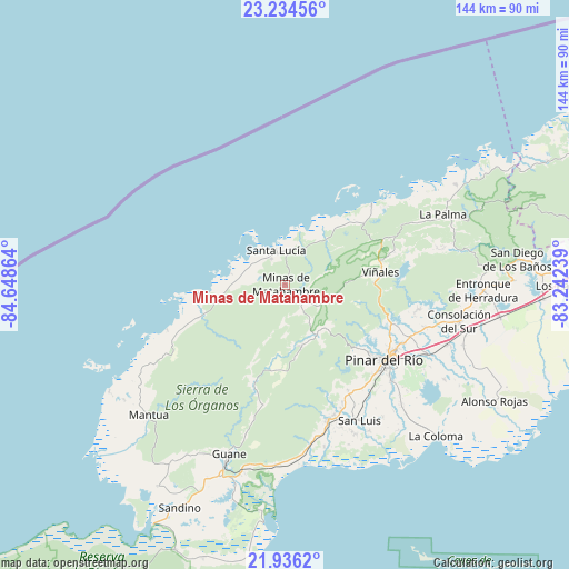
| Upper-left | 23.23456°, | -84.64864° |
| Center: | 22.58691°, | -83.94551° |
| Lower-right: | 21.9362°, | -83.24239° |
| Map W x H: | 144.4×144.4 km | = 89.7×89.7mi |
| max Lat: | 23.15917° ⇑37.6% North |
| Minas de Matahambre: | 22.58691° |
| min Lat: | ⇓62.4% South 19.90553° |
| min Long | Minas de Mataha | max Long |
| -84.28599° | -83.94551° | -74.15181° |
| W 1.1%⇐ | ⇒98.9% E |
Elevation
Elevation of Minas de Matahambre is 133 m = 436 ft, and this is 64.4 m = 211 ft above average elevation for this country.
| Max E: |
761 m = 2497 ft | 10.5% |
| Minas de Matahambre | 133 m 436 ft | |
| Avg. | 68.6 m = 225 ft | |
Min E: |
3 m = 10 ft | 89.5% |
See also: Cuba elevation on elevation.city.
Geographical zone
Minas de Matahambre is located in North Torrid zone (between Equator and Tropic of Cancer). Distance of this Northern Tropic circle is 94.5 km =58.7 mi to North.| Distance of | km | miles | from Minas de Matahambre |
|---|---|---|---|
| North Pole | 7495.6 | 4657.5 | to North |
| Arctic Circle | 4889.7 | 3038.3 | to North |
| Tropic Cancer | 94.5 | 58.7 | to North |
| Equator | 2511.4 | 1560.5 | to South |


Nearby cities:
15 places around Minas de Matahambre: (largest is in red/bold)
• Bahía Honda
87.9 km =54.6 mi,  66°
66°
• Candelaria
102.6 km =63.8 mi,  80°
80°
• Consolación del Sur
45.2 km =28.1 mi,  101°
101°
• Guane
45.2 km =28.1 mi,  198°
198°
• La Palma
44.1 km =27.4 mi, 65°
• Los Palacios
71.7 km =44.6 mi,  89°
89°
• Mantua
48.1 km =29.9 mi,  226°
226°
• Pinar del Río
31.8 km =19.8 mi,  126°
126°
• Puerto Esperanza
30 km =18.6 mi,  47°
47°
• San Cristobal
92.4 km =57.4 mi, 81°
• San Diego de Los Baños
59.5 km =37 mi, 83°
• San Juan y Martínez
35.8 km =22.2 mi,  162°
162°
• San Luis
39.2 km =24.4 mi,  150°
150°
• Soroa
98.2 km =61 mi, 76°
• Viñales
24.7 km =15.3 mi, 81°
Sources, notices
• [Note1] Compared only with cities in Cuba existing in our database
• [Src1] Map data: © OpenStreetMap contributors (CC-BY-SA)
• [Src2] Other city data from geonames.org with taken over terms of usage.
• [Src3] Geographical zone / Annual Mean Temperature by Robert A. Rohde @ Wikipedia
