Psevdás geodata
Psevdás (Larnaka) is a populated place; located in Cyprus in Asia/Nicosia (GMT+2) time zone. With population of 1,070 people, there are 79 cities with bigger population in this country. Compared to other cities in Cyprus, 53% of cities are located further ↑North; 72.6% of cities are located further ←West and 58.1% of cities have lower elevation than Psevdás. Note1


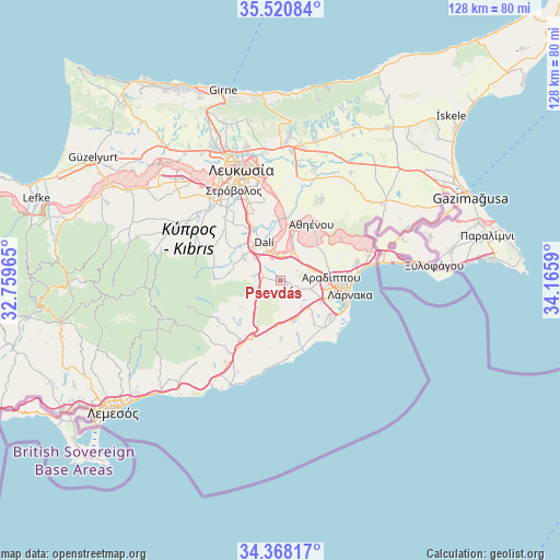
Psevdás GPS coordinates[2]
34° 56' 47.508" North, 33° 27' 45.972" East
| Map corner | latitude | longitude |
|---|---|---|
| Upper-left | 35.52084°, | 32.75965° |
| Center: | 34.94653°, | 33.46277° |
| Lower-right: | 34.36817°, | 34.1659° |
| Map W x H: | 128.2×128.2 km | = 79.7×79.7mi |
| max Lat: | 35.59719° ⇑53% North |
| Psevdás: | 34.94653° |
| min Lat: | ⇓47% South 34.66865° |
| min Long | Psevdás | max Long |
| 32.38166° | 33.46277° | 34.37916° |
| W 72.6%⇐ | ⇒27.4% E |
Elevation
Elevation of Psevdás is 168 m = 551 ft, and this is 40 m = 131 ft below average elevation for this country.
| Max E: |
1134 m = 3720 ft | 41.9% |
| Avg. | 208 m = 682 ft | |
| Psevdás | 168 m = 551 ft | |
Min E: |
4 m = 13 ft | 58.1% |
See also: Cyprus elevation on elevation.city.
Geographical zone
Psevdás is located in North temperate zone (between Tropic of Cancer and the Arctic Circle). Distance of this Northern Tropic circle is 1279.8 km =795.2 mi to South.| Distance of | km | miles | from Psevdás |
|---|---|---|---|
| North Pole | 6121.4 | 3803.7 | to North |
| Arctic Circle | 3515.5 | 2184.4 | to North |
| Tropic Cancer | 1279.8 | 795.2 | to South |
| Equator | 3885.7 | 2414.5 | to South |


Nearby cities:
15 places around Psevdás: (largest is in red/bold)
• Alethrikó
10 km =6.2 mi,  163°
163°
• Alámpra
7.5 km =4.7 mi,  309°
309°
• Anafotída
13.6 km =8.5 mi,  179°
179°
• Aradíppou
11.8 km =7.3 mi,  87°
87°
• Athíenou
14.7 km =9.1 mi,  29°
29°
• Dhromolaxia
13.8 km =8.6 mi,  124°
124°
• Dáli
9.3 km =5.8 mi,  336°
336°
• Kórnos
6.4 km =4 mi,  247°
247°
• Larnaca
14.9 km =9.3 mi,  100°
100°
• Livádia
14.9 km =9.3 mi, 88°
• Lýmpia
5.8 km =3.6 mi,  359°
359°
• Mathiátis
11.7 km =7.3 mi,  279°
279°
• Mosfilotí
3.5 km =2.2 mi, 281°
• Siá
6.7 km =4.2 mi, 278°
• Tersefánou
12.9 km =8 mi,  143°
143°
Sources, notices
• [Note1] Compared only with cities in Cyprus existing in our database
• [Src1] Map data: © OpenStreetMap contributors (CC-BY-SA)
• [Src2] Other city data from geonames.org with taken over terms of usage.
• [Src3] Geographical zone / Annual Mean Temperature by Robert A. Rohde @ Wikipedia
