Zwingenberg geodata
Zwingenberg (Baden-Württemberg) is a seat of a fourth-order administrative division; located in Germany in Europe/Berlin (GMT+2) time zone. With population of 750 people, there are 8099 cities with bigger population in this country. Compared to other cities in Germany, 76.9% of cities are located further ↑North; 64.9% of cities are located further →East and 55.5% of cities have higher elevation than Zwingenberg. Note1
Administrative division(s):
- Level 1: Baden-Württemberg
- Level 2: Karlsruhe Region
- Level 3: Neckar-Odenwald-Kreis
- Level 4: Zwingenberg


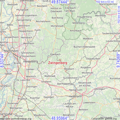
Zwingenberg GPS coordinates[2]
49° 25' 9.012" North, 9° 2' 26.016" East
| Map corner | latitude | longitude |
|---|---|---|
| Upper-left | 49.87444°, | 8.33744° |
| Center: | 49.41917°, | 9.04056° |
| Lower-right: | 48.95964°, | 9.74369° |
| Map W x H: | 101.7×101.7 km | = 63.2×63.2mi |
| max Lat: | 55.01917° ⇑76.9% North |
| Zwingenberg: | 49.41917° |
| min Lat: | ⇓23.1% South 47.40724° |
| min Long | Zwingenberg | max Long |
| 5.92978° | 9.04056° | 14.98853° |
| W 35.1%⇐ | ⇒64.9% E |
Elevation
Elevation of Zwingenberg is 185 m = 607 ft, and this is 64.1 m = 210 ft below average elevation for this country.
| Max E: |
1256 m = 4121 ft | 55.5% |
| Avg. | 249.1 m = 817 ft | |
| Zwingenberg | 185 m = 607 ft | |
Min E: |
-5 m = -16 ft | 44.5% |
See also: Germany elevation on elevation.city.
Geographical zone
Zwingenberg is located in North temperate zone (between Tropic of Cancer and the Arctic Circle). Distance of this North polar circle is 1906.3 km =1184.5 mi to North.| Distance of | km | miles | from Zwingenberg |
|---|---|---|---|
| North Pole | 4512.2 | 2803.8 | to North |
| Arctic Circle | 1906.3 | 1184.5 | to North |
| Tropic Cancer | 2889 | 1795.1 | to South |
| Equator | 5494.9 | 3414.4 | to South |


Nearby cities:
15 places around Zwingenberg: (largest is in red/bold)
• Aglasterhausen
7.9 km =4.9 mi,  209°
209°
• Binau
5.8 km =3.6 mi,  167°
167°
• Eberbach
6.4 km =4 mi,  325°
325°
• Epfenbach
13.1 km =8.1 mi,  227°
227°
• Fahrenbach
8.1 km =5 mi,  80°
80°
• Helmstadt-Bargen
12.1 km =7.5 mi,  195°
195°
• Hirschhorn
10.9 km =6.8 mi,  285°
285°
• Lobbach
12 km =7.5 mi,  245°
245°
• Mosbach
10.8 km =6.7 mi,  132°
132°
• Neckargerach
2.8 km =1.7 mi,  138°
138°
• Neckarzimmern
13 km =8.1 mi,  149°
149°
• Neunkirchen
4.2 km =2.6 mi, 211°
• Obrigheim
8.3 km =5.2 mi, 154°
• Reichartshausen
9.9 km =6.2 mi,  224°
224°
• Rothenberg
12.5 km =7.8 mi,  315°
315°
Sources, notices
• [Note1] Compared only with cities in Germany existing in our database
• [Src1] Map data: © OpenStreetMap contributors (CC-BY-SA)
• [Src2] Other city data from geonames.org with taken over terms of usage.
• [Src3] Geographical zone / Annual Mean Temperature by Robert A. Rohde @ Wikipedia
