Zweiflingen geodata
Zweiflingen (Baden-Württemberg) is a seat of a fourth-order administrative division; located in Germany in Europe/Berlin (GMT+2) time zone. With population of 1,716 people, there are 5486 cities with bigger population in this country. Compared to other cities in Germany, 79.4% of cities are located further ↑North; 57.5% of cities are located further →East and 65.5% of cities have lower elevation than Zweiflingen. Note1
Administrative division(s):
- Level 1: Baden-Württemberg
- Level 2: Regierungsbezirk Stuttgart
- Level 3: Hohenlohekreis
- Level 4: Zweiflingen


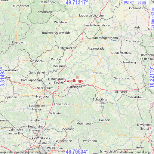
Zweiflingen GPS coordinates[2]
49° 15' 23.004" North, 9° 31' 5.016" East
| Map corner | latitude | longitude |
|---|---|---|
| Upper-left | 49.71317°, | 8.81493° |
| Center: | 49.25639°, | 9.51806° |
| Lower-right: | 48.79534°, | 10.22119° |
| Map W x H: | 102.1×102.1 km | = 63.4×63.4mi |
| max Lat: | 55.01917° ⇑79.4% North |
| Zweiflingen: | 49.25639° |
| min Lat: | ⇓20.6% South 47.40724° |
| min Long | Zweiflingen | max Long |
| 5.92978° | 9.51806° | 14.98853° |
| W 42.5%⇐ | ⇒57.5% E |
Elevation
Elevation of Zweiflingen is 325 m = 1066 ft, and this is 75.9 m = 249 ft above average elevation for this country.
| Max E: |
1256 m = 4121 ft | 34.5% |
| Zweiflingen | 325 m 1066 ft | |
| Avg. | 249.1 m = 817 ft | |
Min E: |
-5 m = -16 ft | 65.5% |
See also: Germany elevation on elevation.city.
Geographical zone
Zweiflingen is located in North temperate zone (between Tropic of Cancer and the Arctic Circle). Distance of this North polar circle is 1924.4 km =1195.8 mi to North.| Distance of | km | miles | from Zweiflingen |
|---|---|---|---|
| North Pole | 4530.3 | 2815 | to North |
| Arctic Circle | 1924.4 | 1195.8 | to North |
| Tropic Cancer | 2870.9 | 1783.9 | to South |
| Equator | 5476.8 | 3403.1 | to South |


Nearby cities:
15 places around Zweiflingen: (largest is in red/bold)
• Bretzfeld
10.3 km =6.4 mi,  214°
214°
• Forchtenberg
4.7 km =2.9 mi,  40°
40°
• Ingelfingen
10.9 km =6.8 mi,  63°
63°
• Jagsthausen
7 km =4.3 mi,  329°
329°
• Kupferzell
12.9 km =8 mi,  104°
104°
• Künzelsau
12.3 km =7.6 mi,  76°
76°
• Langenbrettach
8 km =5 mi,  244°
244°
• Neuenstadt am Kocher
13.7 km =8.5 mi,  259°
259°
• Neuenstein
7.3 km =4.5 mi,  141°
141°
• Niedernhall
8.3 km =5.2 mi, 58°
• Pfedelbach
8.8 km =5.5 mi,  186°
186°
• Waldenburg
11.9 km =7.4 mi,  132°
132°
• Weißbach
7.2 km =4.5 mi,  51°
51°
• Widdern
9.8 km =6.1 mi,  314°
314°
• Öhringen
6.4 km =4 mi, 187°
Sources, notices
• [Note1] Compared only with cities in Germany existing in our database
• [Src1] Map data: © OpenStreetMap contributors (CC-BY-SA)
• [Src2] Other city data from geonames.org with taken over terms of usage.
• [Src3] Geographical zone / Annual Mean Temperature by Robert A. Rohde @ Wikipedia
