Moosach geodata
Moosach (Bavaria) is a seat of a fourth-order administrative division; located in Germany in Europe/Berlin (GMT+2) time zone. With population of 1,333 people, there are 6217 cities with bigger population in this country. Compared to other cities in Germany, 95.1% of cities are located further ↑North; 80% of cities are located further ←West and 91.2% of cities have lower elevation than Moosach. Note1
Administrative division(s):
- Level 1: Bavaria
- Level 2: Upper Bavaria
- Level 3: Landkreis Ebersberg
- Level 4: Moosach


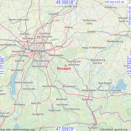
Moosach GPS coordinates[2]
48° 1' 55.668" North, 11° 52' 30.36" East
| Map corner | latitude | longitude |
|---|---|---|
| Upper-left | 48.50018°, | 11.17198° |
| Center: | 48.03213°, | 11.8751° |
| Lower-right: | 47.55979°, | 12.57823° |
| Map W x H: | 104.6×104.6 km | = 65×65mi |
| max Lat: | 55.01917° ⇑95.1% North |
| Moosach: | 48.03213° |
| min Lat: | ⇓4.9% South 47.40724° |
| min Long | Moosach | max Long |
| 5.92978° | 11.8751° | 14.98853° |
| W 80%⇐ | ⇒20% E |
Elevation
Elevation of Moosach is 530 m = 1739 ft, and this is 280.9 m = 922 ft above average elevation for this country.
| Max E: |
1256 m = 4121 ft | 8.8% |
| Moosach | 530 m 1739 ft | |
| Avg. | 249.1 m = 817 ft | |
Min E: |
-5 m = -16 ft | 91.2% |
See also: Germany elevation on elevation.city.
Geographical zone
Moosach is located in North temperate zone (between Tropic of Cancer and the Arctic Circle). Distance of this North polar circle is 2060.5 km =1280.3 mi to North.| Distance of | km | miles | from Moosach |
|---|---|---|---|
| North Pole | 4666.4 | 2899.6 | to North |
| Arctic Circle | 2060.5 | 1280.3 | to North |
| Tropic Cancer | 2734.8 | 1699.3 | to South |
| Equator | 5340.7 | 3318.6 | to South |


Nearby cities:
15 places around Moosach: (largest is in red/bold)
• Aying
10 km =6.2 mi,  226°
226°
• Aßling
10.7 km =6.6 mi,  114°
114°
• Bruck
2.7 km =1.7 mi,  116°
116°
• Ebersberg
8.7 km =5.4 mi,  54°
54°
• Egmating
6.7 km =4.2 mi,  242°
242°
• Eschenlohe
11.6 km =7.2 mi,  98°
98°
• Glonn
5 km =3.1 mi,  186°
186°
• Grafing bei München
7.1 km =4.4 mi,  77°
77°
• Grasbrunn
11.1 km =6.9 mi,  298°
298°
• Hohenthann
8.6 km =5.3 mi,  134°
134°
• Höhenkirchen-Siegertsbrunn
11.7 km =7.3 mi,  263°
263°
• Kirchseeon
4.5 km =2.8 mi,  13°
13°
• Oberpframmern
4.7 km =2.9 mi, 256°
• Vaterstetten
11.4 km =7.1 mi,  315°
315°
• Zorneding
6.9 km =4.3 mi,  327°
327°
Sources, notices
• [Note1] Compared only with cities in Germany existing in our database
• [Src1] Map data: © OpenStreetMap contributors (CC-BY-SA)
• [Src2] Other city data from geonames.org with taken over terms of usage.
• [Src3] Geographical zone / Annual Mean Temperature by Robert A. Rohde @ Wikipedia
