Zöllnitz geodata
Zöllnitz (Thuringia) is a seat of a fourth-order administrative division; located in Germany in Europe/Berlin (GMT+2) time zone. With population of 724 people, there are 8220 cities with bigger population in this country. Compared to other cities in Germany, 55.6% of cities are located further ↓South; 76.3% of cities are located further ←West and 57% of cities have higher elevation than Zöllnitz. Note1


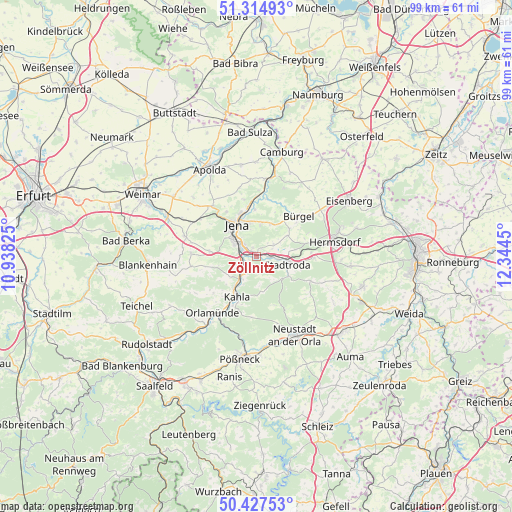
Zöllnitz GPS coordinates[2]
50° 52' 24.024" North, 11° 38' 28.932" East
| Map corner | latitude | longitude |
|---|---|---|
| Upper-left | 51.31493°, | 10.93825° |
| Center: | 50.87334°, | 11.64137° |
| Lower-right: | 50.42753°, | 12.3445° |
| Map W x H: | 98.7×98.7 km | = 61.3×61.3mi |
| max Lat: | 55.01917° ⇑44.4% North |
| Zöllnitz: | 50.87334° |
| min Lat: | ⇓55.6% South 47.40724° |
| min Long | Zöllnitz | max Long |
| 5.92978° | 11.64137° | 14.98853° |
| W 76.3%⇐ | ⇒23.7% E |
Elevation
Elevation of Zöllnitz is 174 m = 571 ft, and this is 75.1 m = 246 ft below average elevation for this country.
| Max E: |
1256 m = 4121 ft | 57% |
| Avg. | 249.1 m = 817 ft | |
| Zöllnitz | 174 m = 571 ft | |
Min E: |
-5 m = -16 ft | 43% |
See also: Germany elevation on elevation.city.
Geographical zone
Zöllnitz is located in North temperate zone (between Tropic of Cancer and the Arctic Circle). Distance of this North polar circle is 1744.6 km =1084 mi to North.| Distance of | km | miles | from Zöllnitz |
|---|---|---|---|
| North Pole | 4350.5 | 2703.3 | to North |
| Arctic Circle | 1744.6 | 1084 | to North |
| Tropic Cancer | 3050.7 | 1895.6 | to South |
| Equator | 5656.6 | 3514.8 | to South |


Nearby cities:
15 places around Zöllnitz: (largest is in red/bold)
• Geisenhain
6.9 km =4.3 mi,  130°
130°
• Großbockedra
2.7 km =1.7 mi,  166°
166°
• Großlöbichau
6.7 km =4.2 mi,  24°
24°
• Großpürschütz
6.9 km =4.3 mi,  204°
204°
• Kleinbockedra
2.7 km =1.7 mi, 166°
• Laasdorf
2.2 km =1.4 mi,  95°
95°
• Rausdorf
3 km =1.9 mi, 104°
• Rothenstein
3.9 km =2.4 mi,  228°
228°
• Ruttersdorf-Lotschen
6.5 km =4 mi,  80°
80°
• Schlöben
4.1 km =2.5 mi,  55°
55°
• Schöngleina
6.9 km =4.3 mi, 56°
• Schöps
5.3 km =3.3 mi,  213°
213°
• Stadtroda
6.3 km =3.9 mi,  107°
107°
• Sulza
1.9 km =1.2 mi,  246°
246°
• Unterbodnitz
6.3 km =3.9 mi, 174°
Sources, notices
• [Note1] Compared only with cities in Germany existing in our database
• [Src1] Map data: © OpenStreetMap contributors (CC-BY-SA)
• [Src2] Other city data from geonames.org with taken over terms of usage.
• [Src3] Geographical zone / Annual Mean Temperature by Robert A. Rohde @ Wikipedia
