Laasdorf geodata
Laasdorf (Thuringia) is a seat of a fourth-order administrative division; located in Germany in Europe/Berlin (GMT+2) time zone. With population of 558 people, there are 9037 cities with bigger population in this country. Compared to other cities in Germany, 55.6% of cities are located further ↓South; 76.8% of cities are located further ←West and 57.6% of cities have higher elevation than Laasdorf. Note1


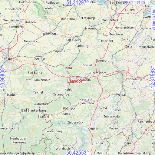
Laasdorf GPS coordinates[2]
50° 52' 16.896" North, 11° 40' 21" East
| Map corner | latitude | longitude |
|---|---|---|
| Upper-left | 51.31297°, | 10.96938° |
| Center: | 50.87136°, | 11.6725° |
| Lower-right: | 50.42553°, | 12.37563° |
| Map W x H: | 98.7×98.7 km | = 61.3×61.3mi |
| max Lat: | 55.01917° ⇑44.4% North |
| Laasdorf: | 50.87136° |
| min Lat: | ⇓55.6% South 47.40724° |
| min Long | Laasdorf | max Long |
| 5.92978° | 11.6725° | 14.98853° |
| W 76.8%⇐ | ⇒23.2% E |
Elevation
Elevation of Laasdorf is 170 m = 558 ft, and this is 79.1 m = 260 ft below average elevation for this country.
| Max E: |
1256 m = 4121 ft | 57.6% |
| Avg. | 249.1 m = 817 ft | |
| Laasdorf | 170 m = 558 ft | |
Min E: |
-5 m = -16 ft | 42.4% |
See also: Germany elevation on elevation.city.
Geographical zone
Laasdorf is located in North temperate zone (between Tropic of Cancer and the Arctic Circle). Distance of this North polar circle is 1744.8 km =1084.2 mi to North.| Distance of | km | miles | from Laasdorf |
|---|---|---|---|
| North Pole | 4350.7 | 2703.4 | to North |
| Arctic Circle | 1744.8 | 1084.2 | to North |
| Tropic Cancer | 3050.4 | 1895.4 | to South |
| Equator | 5656.4 | 3514.7 | to South |


Nearby cities:
15 places around Laasdorf: (largest is in red/bold)
• Geisenhain
5.2 km =3.2 mi,  143°
143°
• Gneus
6.1 km =3.8 mi,  172°
172°
• Großbockedra
2.9 km =1.8 mi,  213°
213°
• Großlöbichau
6.3 km =3.9 mi,  4°
4°
• Kleinbockedra
2.9 km =1.8 mi, 213°
• Rausdorf
0.9 km =0.6 mi,  124°
124°
• Rothenstein
5.6 km =3.5 mi,  244°
244°
• Ruttersdorf-Lotschen
4.5 km =2.8 mi,  72°
72°
• Schlöben
2.8 km =1.7 mi,  24°
24°
• Schöngleina
5.4 km =3.4 mi,  41°
41°
• Stadtroda
4.1 km =2.5 mi,  112°
112°
• Sulza
4 km =2.5 mi,  262°
262°
• Tissa
5.9 km =3.7 mi, 113°
• Tröbnitz
6 km =3.7 mi,  134°
134°
• Zöllnitz
2.2 km =1.4 mi,  275°
275°
Sources, notices
• [Note1] Compared only with cities in Germany existing in our database
• [Src1] Map data: © OpenStreetMap contributors (CC-BY-SA)
• [Src2] Other city data from geonames.org with taken over terms of usage.
• [Src3] Geographical zone / Annual Mean Temperature by Robert A. Rohde @ Wikipedia
