Zeithain geodata
Zeithain (Saxony) is a seat of a fourth-order administrative division; located in Germany in Europe/Berlin (GMT+1) time zone. With population of 5,839 people, there are 2513 cities with bigger population in this country. Compared to other cities in Germany, 63.8% of cities are located further ↓South; 94.6% of cities are located further ←West and 68.8% of cities have higher elevation than Zeithain. Note1


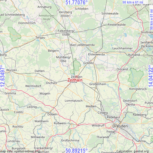
Zeithain GPS coordinates[2]
51° 20' 0.816" North, 13° 20' 17.124" East
| Map corner | latitude | longitude |
|---|---|---|
| Upper-left | 51.77076°, | 12.63497° |
| Center: | 51.33356°, | 13.33809° |
| Lower-right: | 50.89215°, | 14.04122° |
| Map W x H: | 97.7×97.7 km | = 60.7×60.7mi |
| max Lat: | 55.01917° ⇑36.2% North |
| Zeithain: | 51.33356° |
| min Lat: | ⇓63.8% South 47.40724° |
| min Long | Zeithain | max Long |
| 5.92978° | 13.33809° | 14.98853° |
| W 94.6%⇐ | ⇒5.4% E |
Elevation
Elevation of Zeithain is 98 m = 322 ft, and this is 151.1 m = 496 ft below average elevation for this country.
| Max E: |
1256 m = 4121 ft | 68.8% |
| Avg. | 249.1 m = 817 ft | |
| Zeithain | 98 m = 322 ft | |
Min E: |
-5 m = -16 ft | 31.2% |
See also: Germany elevation on elevation.city.
Geographical zone
Zeithain is located in North temperate zone (between Tropic of Cancer and the Arctic Circle). Distance of this North polar circle is 1693.4 km =1052.2 mi to North.| Distance of | km | miles | from Zeithain |
|---|---|---|---|
| North Pole | 4299.3 | 2671.5 | to North |
| Arctic Circle | 1693.4 | 1052.2 | to North |
| Tropic Cancer | 3101.8 | 1927.4 | to South |
| Equator | 5707.8 | 3546.7 | to South |


Nearby cities:
15 places around Zeithain: (largest is in red/bold)
• Cavertitz
15.3 km =9.5 mi,  291°
291°
• Glaubitz
2.9 km =1.8 mi,  108°
108°
• Großenhain
14.4 km =8.9 mi, 109°
• Merzdorf
15.4 km =9.6 mi,  61°
61°
• Mühlberg
13.8 km =8.6 mi,  324°
324°
• Nauwalde
10.7 km =6.6 mi,  27°
27°
• Nünchritz
5 km =3.1 mi,  138°
138°
• Priestewitz
15.5 km =9.6 mi,  126°
126°
• Riesa
4.3 km =2.7 mi,  228°
228°
• Stauchitz
13.2 km =8.2 mi,  220°
220°
• Strehla
8 km =5 mi, 285°
• Weißig
8.5 km =5.3 mi,  122°
122°
• Wildenhain
10.1 km =6.3 mi, 106°
• Wülknitz
5.7 km =3.5 mi,  49°
49°
• Zabeltitz
11.7 km =7.3 mi,  80°
80°
Sources, notices
• [Note1] Compared only with cities in Germany existing in our database
• [Src1] Map data: © OpenStreetMap contributors (CC-BY-SA)
• [Src2] Other city data from geonames.org with taken over terms of usage.
• [Src3] Geographical zone / Annual Mean Temperature by Robert A. Rohde @ Wikipedia
