Nauwalde geodata
Nauwalde (Saxony) is a populated place; located in Germany in Europe/Berlin (GMT+2) time zone. With population of 1,119 people, there are 6795 cities with bigger population in this country. Compared to other cities in Germany, 65.1% of cities are located further ↓South; 95.2% of cities are located further ←West and 69.5% of cities have higher elevation than Nauwalde. Note1


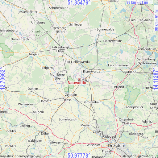
Nauwalde GPS coordinates[2]
51° 25' 6.132" North, 13° 24' 35.064" East
| Map corner | latitude | longitude |
|---|---|---|
| Upper-left | 51.85476°, | 12.70662° |
| Center: | 51.41837°, | 13.40974° |
| Lower-right: | 50.97778°, | 14.11287° |
| Map W x H: | 97.5×97.5 km | = 60.6×60.6mi |
| max Lat: | 55.01917° ⇑34.9% North |
| Nauwalde: | 51.41837° |
| min Lat: | ⇓65.1% South 47.40724° |
| min Long | Nauwalde | max Long |
| 5.92978° | 13.40974° | 14.98853° |
| W 95.2%⇐ | ⇒4.8% E |
Elevation
Elevation of Nauwalde is 94 m = 308 ft, and this is 155.1 m = 509 ft below average elevation for this country.
| Max E: |
1256 m = 4121 ft | 69.5% |
| Avg. | 249.1 m = 817 ft | |
| Nauwalde | 94 m = 308 ft | |
Min E: |
-5 m = -16 ft | 30.5% |
See also: Germany elevation on elevation.city.
Geographical zone
Nauwalde is located in North temperate zone (between Tropic of Cancer and the Arctic Circle). Distance of this North polar circle is 1684 km =1046.4 mi to North.| Distance of | km | miles | from Nauwalde |
|---|---|---|---|
| North Pole | 4289.9 | 2665.6 | to North |
| Arctic Circle | 1684 | 1046.4 | to North |
| Tropic Cancer | 3111.3 | 1933.3 | to South |
| Equator | 5717.2 | 3552.5 | to South |


Nearby cities:
15 places around Nauwalde: (largest is in red/bold)
• Bad Liebenwerda
11.2 km =7 mi,  354°
354°
• Elsterwerda
9 km =5.6 mi,  58°
58°
• Glaubitz
10.6 km =6.6 mi,  191°
191°
• Gröden
11.1 km =6.9 mi,  100°
100°
• Hohenleipisch
13.3 km =8.3 mi,  46°
46°
• Merzdorf
8.8 km =5.5 mi, 103°
• Mühlberg
13.2 km =8.2 mi,  277°
277°
• Nünchritz
13.3 km =8.3 mi, 187°
• Riesa
14.8 km =9.2 mi,  213°
213°
• Strehla
14.7 km =9.1 mi,  240°
240°
• Weißig
14.2 km =8.8 mi,  171°
171°
• Wildenhain
13.2 km =8.2 mi,  159°
159°
• Wülknitz
5.8 km =3.6 mi, 186°
• Zabeltitz
9.9 km =6.2 mi,  138°
138°
• Zeithain
10.7 km =6.6 mi, 207°
Sources, notices
• [Note1] Compared only with cities in Germany existing in our database
• [Src1] Map data: © OpenStreetMap contributors (CC-BY-SA)
• [Src2] Other city data from geonames.org with taken over terms of usage.
• [Src3] Geographical zone / Annual Mean Temperature by Robert A. Rohde @ Wikipedia
