Wurzbach geodata
Wurzbach (Thuringia) is a populated place; located in Germany in Europe/Berlin (GMT+2) time zone. With population of 3,864 people, there are 3372 cities with bigger population in this country. Compared to other cities in Germany, 53.5% of cities are located further ↑North; 74.9% of cities are located further ←West and 90.9% of cities have lower elevation than Wurzbach. Note1


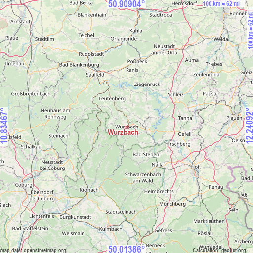
Wurzbach GPS coordinates[2]
50° 27' 48.852" North, 11° 32' 16.044" East
| Map corner | latitude | longitude |
|---|---|---|
| Upper-left | 50.90904°, | 10.83467° |
| Center: | 50.46357°, | 11.53779° |
| Lower-right: | 50.01386°, | 12.24092° |
| Map W x H: | 99.5×99.5 km | = 61.8×61.8mi |
| max Lat: | 55.01917° ⇑53.5% North |
| Wurzbach: | 50.46357° |
| min Lat: | ⇓46.5% South 47.40724° |
| min Long | Wurzbach | max Long |
| 5.92978° | 11.53779° | 14.98853° |
| W 74.9%⇐ | ⇒25.1% E |
Elevation
Elevation of Wurzbach is 526 m = 1726 ft, and this is 276.9 m = 908 ft above average elevation for this country.
| Max E: |
1256 m = 4121 ft | 9.1% |
| Wurzbach | 526 m 1726 ft | |
| Avg. | 249.1 m = 817 ft | |
Min E: |
-5 m = -16 ft | 90.9% |
See also: Germany elevation on elevation.city.
Geographical zone
Wurzbach is located in North temperate zone (between Tropic of Cancer and the Arctic Circle). Distance of this North polar circle is 1790.2 km =1112.4 mi to North.| Distance of | km | miles | from Wurzbach |
|---|---|---|---|
| North Pole | 4396 | 2731.5 | to North |
| Arctic Circle | 1790.2 | 1112.4 | to North |
| Tropic Cancer | 3005.1 | 1867.3 | to South |
| Equator | 5611 | 3486.5 | to South |


Nearby cities:
15 places around Wurzbach: (largest is in red/bold)
• Bad Lobenstein
7.3 km =4.5 mi,  99°
99°
• Bad Steben
13.2 km =8.2 mi,  145°
145°
• Blankenstein
13.3 km =8.3 mi,  120°
120°
• Drognitz
14 km =8.7 mi,  10°
10°
• Harra
11.6 km =7.2 mi, 116°
• Leutenberg
12.5 km =7.8 mi,  332°
332°
• Lichtenberg
13.3 km =8.3 mi,  132°
132°
• Ludwigsstadt
10.9 km =6.8 mi,  283°
283°
• Nordhalben
10.1 km =6.3 mi,  191°
191°
• Probstzella
13.4 km =8.3 mi,  305°
305°
• Reichenbach
9.9 km =6.2 mi,  243°
243°
• Remptendorf
11.1 km =6.9 mi,  45°
45°
• Schlegel
9 km =5.6 mi,  141°
141°
• Teuschnitz
13.2 km =8.2 mi, 236°
• Tschirn
9.4 km =5.8 mi,  221°
221°
Sources, notices
• [Note1] Compared only with cities in Germany existing in our database
• [Src1] Map data: © OpenStreetMap contributors (CC-BY-SA)
• [Src2] Other city data from geonames.org with taken over terms of usage.
• [Src3] Geographical zone / Annual Mean Temperature by Robert A. Rohde @ Wikipedia
