Wolfersdorf geodata
Wolfersdorf (Bavaria) is a seat of a fourth-order administrative division; located in Germany in Europe/Berlin (GMT+2) time zone. With population of 2,327 people, there are 4639 cities with bigger population in this country. Compared to other cities in Germany, 89.4% of cities are located further ↑North; 77.3% of cities are located further ←West and 88.7% of cities have lower elevation than Wolfersdorf. Note1
Administrative division(s):
- Level 1: Bavaria
- Level 2: Upper Bavaria
- Level 3: Landkreis Freising
- Level 4: Wolfersdorf


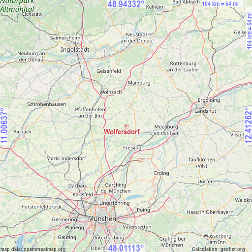
Wolfersdorf GPS coordinates[2]
48° 28' 45.732" North, 11° 42' 34.164" East
| Map corner | latitude | longitude |
|---|---|---|
| Upper-left | 48.94332°, | 11.00637° |
| Center: | 48.47937°, | 11.70949° |
| Lower-right: | 48.01113°, | 12.41262° |
| Map W x H: | 103.6×103.6 km | = 64.4×64.4mi |
| max Lat: | 55.01917° ⇑89.4% North |
| Wolfersdorf: | 48.47937° |
| min Lat: | ⇓10.6% South 47.40724° |
| min Long | Wolfersdorf | max Long |
| 5.92978° | 11.70949° | 14.98853° |
| W 77.3%⇐ | ⇒22.7% E |
Elevation
Elevation of Wolfersdorf is 501 m = 1644 ft, and this is 251.9 m = 826 ft above average elevation for this country.
| Max E: |
1256 m = 4121 ft | 11.3% |
| Wolfersdorf | 501 m 1644 ft | |
| Avg. | 249.1 m = 817 ft | |
Min E: |
-5 m = -16 ft | 88.7% |
See also: Germany elevation on elevation.city.
Geographical zone
Wolfersdorf is located in North temperate zone (between Tropic of Cancer and the Arctic Circle). Distance of this North polar circle is 2010.8 km =1249.5 mi to North.| Distance of | km | miles | from Wolfersdorf |
|---|---|---|---|
| North Pole | 4616.7 | 2868.7 | to North |
| Arctic Circle | 2010.8 | 1249.5 | to North |
| Tropic Cancer | 2784.5 | 1730.2 | to South |
| Equator | 5390.4 | 3349.4 | to South |


Nearby cities:
15 places around Wolfersdorf: (largest is in red/bold)
• Allershausen
9.6 km =6 mi,  237°
237°
• Attenkirchen
4.7 km =2.9 mi,  52°
52°
• Au in der Hallertau
9.1 km =5.7 mi,  14°
14°
• Freising
8.9 km =5.5 mi,  161°
161°
• Haag an der Amper
9 km =5.6 mi,  104°
104°
• Hörgertshausen
14 km =8.7 mi,  55°
55°
• Kirchdorf
4.6 km =2.9 mi, 241°
• Kirchdorf
13.1 km =8.1 mi,  17°
17°
• Kranzberg
10.8 km =6.7 mi,  221°
221°
• Langenbach
11.6 km =7.2 mi,  116°
116°
• Marzling
10 km =6.2 mi,  141°
141°
• Nandlstadt
9.6 km =6 mi, 48°
• Paunzhausen
10.7 km =6.6 mi,  267°
267°
• Schweitenkirchen
8.2 km =5.1 mi,  289°
289°
• Zolling
5.3 km =3.3 mi,  127°
127°
Sources, notices
• [Note1] Compared only with cities in Germany existing in our database
• [Src1] Map data: © OpenStreetMap contributors (CC-BY-SA)
• [Src2] Other city data from geonames.org with taken over terms of usage.
• [Src3] Geographical zone / Annual Mean Temperature by Robert A. Rohde @ Wikipedia
