Kirchdorf geodata
Kirchdorf (Bavaria) is a populated place; located in Germany in Europe/Berlin (GMT+2) time zone. With population of 2,652 people, there are 4280 cities with bigger population in this country. Compared to other cities in Germany, 89.6% of cities are located further ↑North; 76.6% of cities are located further ←West and 81.2% of cities have lower elevation than Kirchdorf. Note1
Administrative division(s):
- Level 1: Bavaria
- Level 2: Upper Bavaria
- Level 3: Landkreis Freising
- Level 4: Kirchdorf a.d.Amper


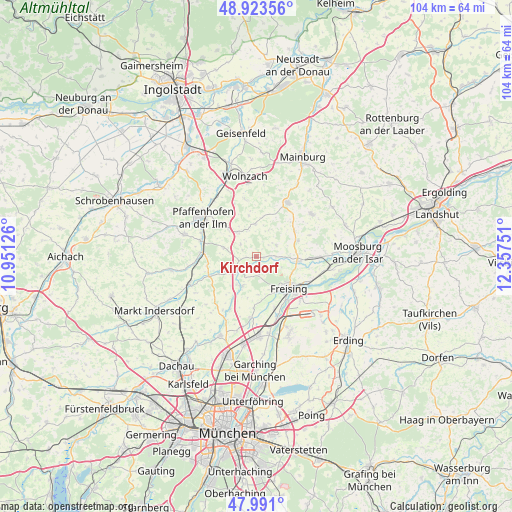
Kirchdorf GPS coordinates[2]
48° 27' 33.912" North, 11° 39' 15.768" East
| Map corner | latitude | longitude |
|---|---|---|
| Upper-left | 48.92356°, | 10.95126° |
| Center: | 48.45942°, | 11.65438° |
| Lower-right: | 47.991°, | 12.35751° |
| Map W x H: | 103.7×103.7 km | = 64.4×64.4mi |
| max Lat: | 55.01917° ⇑89.6% North |
| Kirchdorf: | 48.45942° |
| min Lat: | ⇓10.4% South 47.40724° |
| min Long | Kirchdorf | max Long |
| 5.92978° | 11.65438° | 14.98853° |
| W 76.6%⇐ | ⇒23.4% E |
Elevation
Elevation of Kirchdorf is 441 m = 1447 ft, and this is 191.9 m = 630 ft above average elevation for this country.
| Max E: |
1256 m = 4121 ft | 18.8% |
| Kirchdorf | 441 m 1447 ft | |
| Avg. | 249.1 m = 817 ft | |
Min E: |
-5 m = -16 ft | 81.2% |
See also: Germany elevation on elevation.city.
Geographical zone
Kirchdorf is located in North temperate zone (between Tropic of Cancer and the Arctic Circle). Distance of this North polar circle is 2013 km =1250.8 mi to North.| Distance of | km | miles | from Kirchdorf |
|---|---|---|---|
| North Pole | 4618.9 | 2870.1 | to North |
| Arctic Circle | 2013 | 1250.8 | to North |
| Tropic Cancer | 2782.3 | 1728.8 | to South |
| Equator | 5388.2 | 3348.1 | to South |


Nearby cities:
15 places around Kirchdorf: (largest is in red/bold)
• Allershausen
4.9 km =3 mi,  234°
234°
• Attenkirchen
9.3 km =5.8 mi,  56°
56°
• Au in der Hallertau
12.7 km =7.9 mi,  30°
30°
• Freising
9.3 km =5.8 mi,  131°
131°
• Haag an der Amper
12.8 km =8 mi,  90°
90°
• Hettenshausen
12.2 km =7.6 mi,  291°
291°
• Hohenkammer
10.3 km =6.4 mi,  247°
247°
• Ilmmünster
11.7 km =7.3 mi,  283°
283°
• Kranzberg
6.7 km =4.2 mi,  207°
207°
• Marzling
11.7 km =7.3 mi,  118°
118°
• Paunzhausen
6.8 km =4.2 mi, 284°
• Reichertshausen
10.2 km =6.3 mi,  274°
274°
• Schweitenkirchen
6.1 km =3.8 mi,  323°
323°
• Wolfersdorf
4.6 km =2.9 mi, 61°
• Zolling
8.3 km =5.2 mi,  97°
97°
Sources, notices
• [Note1] Compared only with cities in Germany existing in our database
• [Src1] Map data: © OpenStreetMap contributors (CC-BY-SA)
• [Src2] Other city data from geonames.org with taken over terms of usage.
• [Src3] Geographical zone / Annual Mean Temperature by Robert A. Rohde @ Wikipedia
