Langenbach geodata
Langenbach (Bavaria) is a seat of a fourth-order administrative division; located in Germany in Europe/Berlin (GMT+2) time zone. With population of 3,755 people, there are 3438 cities with bigger population in this country. Compared to other cities in Germany, 89.9% of cities are located further ↑North; 79.5% of cities are located further ←West and 80.2% of cities have lower elevation than Langenbach. Note1
Administrative division(s):
- Level 1: Bavaria
- Level 2: Upper Bavaria
- Level 3: Landkreis Freising
- Level 4: Langenbach


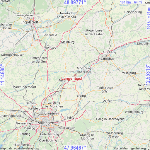
Langenbach GPS coordinates[2]
48° 25' 59.988" North, 11° 51' 0" East
| Map corner | latitude | longitude |
|---|---|---|
| Upper-left | 48.89771°, | 11.14688° |
| Center: | 48.43333°, | 11.85° |
| Lower-right: | 47.96467°, | 12.55313° |
| Map W x H: | 103.7×103.7 km | = 64.4×64.4mi |
| max Lat: | 55.01917° ⇑89.9% North |
| Langenbach: | 48.43333° |
| min Lat: | ⇓10.1% South 47.40724° |
| min Long | Langenbach | max Long |
| 5.92978° | 11.85° | 14.98853° |
| W 79.5%⇐ | ⇒20.5% E |
Elevation
Elevation of Langenbach is 434 m = 1424 ft, and this is 184.9 m = 607 ft above average elevation for this country.
| Max E: |
1256 m = 4121 ft | 19.8% |
| Langenbach | 434 m 1424 ft | |
| Avg. | 249.1 m = 817 ft | |
Min E: |
-5 m = -16 ft | 80.2% |
See also: Germany elevation on elevation.city.
Geographical zone
Langenbach is located in North temperate zone (between Tropic of Cancer and the Arctic Circle). Distance of this North polar circle is 2015.9 km =1252.6 mi to North.| Distance of | km | miles | from Langenbach |
|---|---|---|---|
| North Pole | 4621.8 | 2871.9 | to North |
| Arctic Circle | 2015.9 | 1252.6 | to North |
| Tropic Cancer | 2779.4 | 1727 | to South |
| Equator | 5385.3 | 3346.3 | to South |


Nearby cities:
15 places around Langenbach: (largest is in red/bold)
• Attenkirchen
10.4 km =6.5 mi,  320°
320°
• Berglern
8.1 km =5 mi,  132°
132°
• Eitting
8.7 km =5.4 mi,  159°
159°
• Freising
8.2 km =5.1 mi,  246°
246°
• Haag an der Amper
3.2 km =2 mi,  329°
329°
• Hörgertshausen
13 km =8.1 mi,  5°
5°
• Langenpreising
9.1 km =5.7 mi,  95°
95°
• Marzling
4.9 km =3 mi,  236°
236°
• Mauern
10 km =6.2 mi,  21°
21°
• Moosburg
7.7 km =4.8 mi,  57°
57°
• Nandlstadt
11.9 km =7.4 mi,  344°
344°
• Wang
9.4 km =5.8 mi,  42°
42°
• Wartenberg
10.7 km =6.6 mi,  106°
106°
• Wolfersdorf
11.6 km =7.2 mi,  296°
296°
• Zolling
6.4 km =4 mi,  286°
286°
Sources, notices
• [Note1] Compared only with cities in Germany existing in our database
• [Src1] Map data: © OpenStreetMap contributors (CC-BY-SA)
• [Src2] Other city data from geonames.org with taken over terms of usage.
• [Src3] Geographical zone / Annual Mean Temperature by Robert A. Rohde @ Wikipedia
