Wolfen geodata
Wolfen (Saxony-Anhalt) is a populated place; located in Germany in Europe/Berlin (GMT+2) time zone. With population of 25,251 people, there are 579 cities with bigger population in this country. Compared to other cities in Germany, 68.4% of cities are located further ↓South; 85.5% of cities are located further ←West and 70.2% of cities have higher elevation than Wolfen. Note1
Administrative division(s):
- Level 1: Saxony-Anhalt
- Level 3: Anhalt-Bitterfeld
- Level 4: Bitterfeld-Wolfen


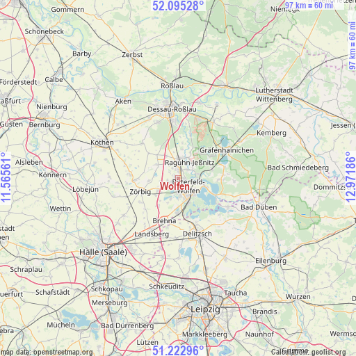
Wolfen GPS coordinates[2]
51° 39' 40.392" North, 12° 16' 7.428" East
| Map corner | latitude | longitude |
|---|---|---|
| Upper-left | 52.09528°, | 11.56561° |
| Center: | 51.66122°, | 12.26873° |
| Lower-right: | 51.22296°, | 12.97186° |
| Map W x H: | 97×97 km | = 60.3×60.3mi |
| max Lat: | 55.01917° ⇑31.6% North |
| Wolfen: | 51.66122° |
| min Lat: | ⇓68.4% South 47.40724° |
| min Long | Wolfen | max Long |
| 5.92978° | 12.26873° | 14.98853° |
| W 85.5%⇐ | ⇒14.5% E |
Elevation
Elevation of Wolfen is 90 m = 295 ft, and this is 159.1 m = 522 ft below average elevation for this country.
| Max E: |
1256 m = 4121 ft | 70.2% |
| Avg. | 249.1 m = 817 ft | |
| Wolfen | 90 m = 295 ft | |
Min E: |
-5 m = -16 ft | 29.8% |
See also: Germany elevation on elevation.city.
Geographical zone
Wolfen is located in North temperate zone (between Tropic of Cancer and the Arctic Circle). Distance of this North polar circle is 1657 km =1029.6 mi to North.| Distance of | km | miles | from Wolfen |
|---|---|---|---|
| North Pole | 4262.9 | 2648.8 | to North |
| Arctic Circle | 1657 | 1029.6 | to North |
| Tropic Cancer | 3138.3 | 1950 | to South |
| Equator | 5744.2 | 3569.3 | to South |


Nearby cities:
15 places around Wolfen: (largest is in red/bold)
• Bitterfeld-Wolfen
5.7 km =3.5 mi,  137°
137°
• Bobbau
2.9 km =1.8 mi,  5°
5°
• Friedersdorf
6.8 km =4.2 mi,  102°
102°
• Greppin
2.7 km =1.7 mi,  126°
126°
• Großzöberitz
7.7 km =4.8 mi,  233°
233°
• Holzweißig
7.5 km =4.7 mi,  158°
158°
• Jeßnitz
3.2 km =2 mi,  41°
41°
• Muldenstein
5.4 km =3.4 mi,  77°
77°
• Raguhn
5.6 km =3.5 mi,  4°
4°
• Ramsin
6 km =3.7 mi,  200°
200°
• Renneritz
7.3 km =4.5 mi, 204°
• Salzfurtkapelle
7.2 km =4.5 mi,  300°
300°
• Sandersdorf
3.7 km =2.3 mi,  184°
184°
• Thalheim
3 km =1.9 mi,  251°
251°
• Zscherndorf
5.6 km =3.5 mi, 180°
Sources, notices
• [Note1] Compared only with cities in Germany existing in our database
• [Src1] Map data: © OpenStreetMap contributors (CC-BY-SA)
• [Src2] Other city data from geonames.org with taken over terms of usage.
• [Src3] Geographical zone / Annual Mean Temperature by Robert A. Rohde @ Wikipedia
