Thalheim geodata
Thalheim (Saxony-Anhalt) is a populated place; located in Germany in Europe/Berlin (GMT+2) time zone. With population of 1,558 people, there are 5765 cities with bigger population in this country. Compared to other cities in Germany, 68.3% of cities are located further ↓South; 85% of cities are located further ←West and 70.7% of cities have higher elevation than Thalheim. Note1
Administrative division(s):
- Level 1: Saxony-Anhalt
- Level 3: Anhalt-Bitterfeld
- Level 4: Bitterfeld-Wolfen


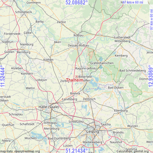
Thalheim GPS coordinates[2]
51° 39' 9.648" North, 12° 13' 39.216" East
| Map corner | latitude | longitude |
|---|---|---|
| Upper-left | 52.08682°, | 11.52444° |
| Center: | 51.65268°, | 12.22756° |
| Lower-right: | 51.21434°, | 12.93069° |
| Map W x H: | 97×97 km | = 60.3×60.3mi |
| max Lat: | 55.01917° ⇑31.7% North |
| Thalheim: | 51.65268° |
| min Lat: | ⇓68.3% South 47.40724° |
| min Long | Thalheim | max Long |
| 5.92978° | 12.22756° | 14.98853° |
| W 85%⇐ | ⇒15% E |
Elevation
Elevation of Thalheim is 87 m = 285 ft, and this is 162.1 m = 532 ft below average elevation for this country.
| Max E: |
1256 m = 4121 ft | 70.7% |
| Avg. | 249.1 m = 817 ft | |
| Thalheim | 87 m = 285 ft | |
Min E: |
-5 m = -16 ft | 29.3% |
See also: Germany elevation on elevation.city.
Geographical zone
Thalheim is located in North temperate zone (between Tropic of Cancer and the Arctic Circle). Distance of this North polar circle is 1657.9 km =1030.2 mi to North.| Distance of | km | miles | from Thalheim |
|---|---|---|---|
| North Pole | 4263.8 | 2649.4 | to North |
| Arctic Circle | 1657.9 | 1030.2 | to North |
| Tropic Cancer | 3137.3 | 1949.4 | to South |
| Equator | 5743.2 | 3568.7 | to South |


Nearby cities:
15 places around Thalheim: (largest is in red/bold)
• Bitterfeld-Wolfen
7.4 km =4.6 mi,  115°
115°
• Bobbau
5 km =3.1 mi,  38°
38°
• Glebitzsch
6.7 km =4.2 mi,  201°
201°
• Greppin
5.1 km =3.2 mi,  97°
97°
• Großzöberitz
5 km =3.1 mi,  222°
222°
• Jeßnitz
6 km =3.7 mi,  55°
55°
• Löberitz
5.6 km =3.5 mi,  271°
271°
• Raguhn
7.3 km =4.5 mi,  26°
26°
• Ramsin
4.7 km =2.9 mi,  171°
171°
• Renneritz
5.7 km =3.5 mi,  181°
181°
• Salzfurtkapelle
5.7 km =3.5 mi,  324°
324°
• Sandersdorf
3.7 km =2.3 mi,  136°
136°
• Wolfen
3 km =1.9 mi,  71°
71°
• Zscherndorf
5.4 km =3.4 mi,  149°
149°
• Zörbig
8 km =5 mi,  250°
250°
Sources, notices
• [Note1] Compared only with cities in Germany existing in our database
• [Src1] Map data: © OpenStreetMap contributors (CC-BY-SA)
• [Src2] Other city data from geonames.org with taken over terms of usage.
• [Src3] Geographical zone / Annual Mean Temperature by Robert A. Rohde @ Wikipedia
