Winterwerb geodata
Winterwerb (Rheinland-Pfalz) is a seat of a fourth-order administrative division; located in Germany in Europe/Berlin (GMT+2) time zone. With population of 183 people, there are 10546 cities with bigger population in this country. Compared to other cities in Germany, 58.2% of cities are located further ↑North; 82.3% of cities are located further →East and 67% of cities have lower elevation than Winterwerb. Note1


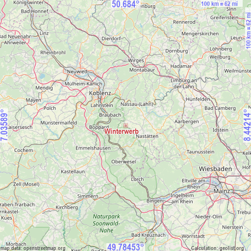
Winterwerb GPS coordinates[2]
50° 14' 11.004" North, 7° 44' 20.436" East
| Map corner | latitude | longitude |
|---|---|---|
| Upper-left | 50.684°, | 7.03589° |
| Center: | 50.23639°, | 7.73901° |
| Lower-right: | 49.78453°, | 8.44214° |
| Map W x H: | 100×100 km | = 62.1×62.1mi |
| max Lat: | 55.01917° ⇑58.2% North |
| Winterwerb: | 50.23639° |
| min Lat: | ⇓41.8% South 47.40724° |
| min Long | Winterwerb | max Long |
| 5.92978° | 7.73901° | 14.98853° |
| W 17.7%⇐ | ⇒82.3% E |
Elevation
Elevation of Winterwerb is 335 m = 1099 ft, and this is 85.9 m = 282 ft above average elevation for this country.
| Max E: |
1256 m = 4121 ft | 33% |
| Winterwerb | 335 m 1099 ft | |
| Avg. | 249.1 m = 817 ft | |
Min E: |
-5 m = -16 ft | 67% |
See also: Germany elevation on elevation.city.
Geographical zone
Winterwerb is located in North temperate zone (between Tropic of Cancer and the Arctic Circle). Distance of this North polar circle is 1815.4 km =1128 mi to North.| Distance of | km | miles | from Winterwerb |
|---|---|---|---|
| North Pole | 4421.3 | 2747.3 | to North |
| Arctic Circle | 1815.4 | 1128 | to North |
| Tropic Cancer | 2979.8 | 1851.6 | to South |
| Equator | 5585.8 | 3470.9 | to South |


Nearby cities:
15 places around Winterwerb: (largest is in red/bold)
• Dachsenhausen
2.1 km =1.3 mi,  337°
337°
• Dahlheim
4.2 km =2.6 mi,  226°
226°
• Dessighofen
3.4 km =2.1 mi,  44°
44°
• Dornholzhausen
5.2 km =3.2 mi, 43°
• Ehr
3.3 km =2.1 mi,  87°
87°
• Eschbach
2.6 km =1.6 mi,  198°
198°
• Geisig
4.1 km =2.5 mi,  62°
62°
• Gemmerich
1.7 km =1.1 mi,  124°
124°
• Hainau
3.4 km =2.1 mi, 115°
• Himmighofen
3.3 km =2.1 mi,  145°
145°
• Kasdorf
4.6 km =2.9 mi,  135°
135°
• Kehlbach
2.9 km =1.8 mi,  29°
29°
• Niederbachheim
2.3 km =1.4 mi, 55°
• Oberbachheim
1.3 km =0.8 mi, 29°
• Schweighausen
5.3 km =3.3 mi,  8°
8°
Sources, notices
• [Note1] Compared only with cities in Germany existing in our database
• [Src1] Map data: © OpenStreetMap contributors (CC-BY-SA)
• [Src2] Other city data from geonames.org with taken over terms of usage.
• [Src3] Geographical zone / Annual Mean Temperature by Robert A. Rohde @ Wikipedia
