Weyhausen geodata
Weyhausen (Lower Saxony) is a seat of a fourth-order administrative division; located in Germany in Europe/Berlin (GMT+2) time zone. With population of 2,654 people, there are 4276 cities with bigger population in this country. Compared to other cities in Germany, 77% of cities are located further ↓South; 62.8% of cities are located further ←West and 77% of cities have higher elevation than Weyhausen. Note1


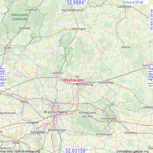
Weyhausen GPS coordinates[2]
52° 27' 43.488" North, 10° 43' 1.164" East
| Map corner | latitude | longitude |
|---|---|---|
| Upper-left | 52.8884°, | 10.01387° |
| Center: | 52.46208°, | 10.71699° |
| Lower-right: | 52.03159°, | 11.42012° |
| Map W x H: | 95.3×95.3 km | = 59.2×59.2mi |
| max Lat: | 55.01917° ⇑23% North |
| Weyhausen: | 52.46208° |
| min Lat: | ⇓77% South 47.40724° |
| min Long | Weyhausen | max Long |
| 5.92978° | 10.71699° | 14.98853° |
| W 62.8%⇐ | ⇒37.2% E |
Elevation
Elevation of Weyhausen is 56 m = 184 ft, and this is 193.1 m = 634 ft below average elevation for this country.
| Max E: |
1256 m = 4121 ft | 77% |
| Avg. | 249.1 m = 817 ft | |
| Weyhausen | 56 m = 184 ft | |
Min E: |
-5 m = -16 ft | 23% |
See also: Germany elevation on elevation.city.
Geographical zone
Weyhausen is located in North temperate zone (between Tropic of Cancer and the Arctic Circle). Distance of this North polar circle is 1567.9 km =974.2 mi to North.| Distance of | km | miles | from Weyhausen |
|---|---|---|---|
| North Pole | 4173.8 | 2593.5 | to North |
| Arctic Circle | 1567.9 | 974.2 | to North |
| Tropic Cancer | 3227.3 | 2005.4 | to South |
| Equator | 5833.2 | 3624.6 | to South |


Nearby cities:
15 places around Weyhausen: (largest is in red/bold)
• Allerbüttel
7 km =4.3 mi,  229°
229°
• Barwedel
7.7 km =4.8 mi,  30°
30°
• Bokensdorf
4.2 km =2.6 mi,  359°
359°
• Calberlah
7.8 km =4.8 mi, 234°
• Detmerode
8.2 km =5.1 mi,  166°
166°
• Isenbüttel
9.6 km =6 mi,  250°
250°
• Jembke
5.4 km =3.4 mi,  38°
38°
• Osloß
2.6 km =1.6 mi,  287°
287°
• Rothenfelde
6.5 km =4 mi,  126°
126°
• Sassenburg
8.3 km =5.2 mi,  316°
316°
• Tappenbeck
1.9 km =1.2 mi,  59°
59°
• Tiddische
8.3 km =5.2 mi, 42°
• Wasbüttel
10 km =6.2 mi,  237°
237°
• Westhagen
6.6 km =4.1 mi, 166°
• Wolfsburg
6 km =3.7 mi, 133°
Sources, notices
• [Note1] Compared only with cities in Germany existing in our database
• [Src1] Map data: © OpenStreetMap contributors (CC-BY-SA)
• [Src2] Other city data from geonames.org with taken over terms of usage.
• [Src3] Geographical zone / Annual Mean Temperature by Robert A. Rohde @ Wikipedia
