Detmerode geodata
Detmerode (Lower Saxony) is a populated place; located in Germany in Europe/Berlin (GMT+2) time zone. With population of 7,640 people, there are 2030 cities with bigger population in this country. Compared to other cities in Germany, 76.1% of cities are located further ↓South; 63.2% of cities are located further ←West and 70% of cities have higher elevation than Detmerode. Note1
Administrative division(s):
- Level 1: Lower Saxony
- Level 3: Kreisfreie Stadt Wolfsburg
- Level 4: Wolfsburg


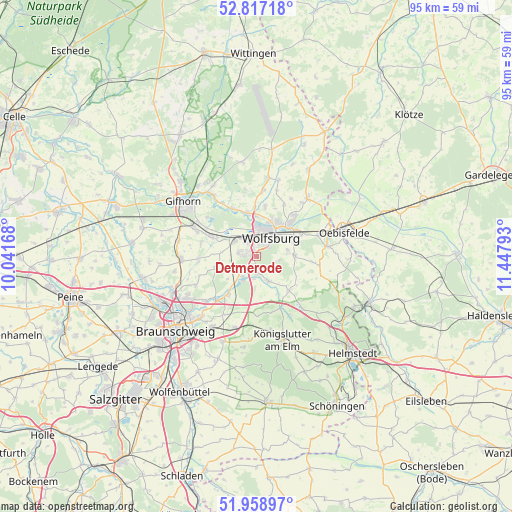
Detmerode GPS coordinates[2]
52° 23' 24.576" North, 10° 44' 41.28" East
| Map corner | latitude | longitude |
|---|---|---|
| Upper-left | 52.81718°, | 10.04168° |
| Center: | 52.39016°, | 10.7448° |
| Lower-right: | 51.95897°, | 11.44793° |
| Map W x H: | 95.4×95.4 km | = 59.3×59.3mi |
| max Lat: | 55.01917° ⇑23.9% North |
| Detmerode: | 52.39016° |
| min Lat: | ⇓76.1% South 47.40724° |
| min Long | Detmerode | max Long |
| 5.92978° | 10.7448° | 14.98853° |
| W 63.2%⇐ | ⇒36.8% E |
Elevation
Elevation of Detmerode is 91 m = 299 ft, and this is 158.1 m = 519 ft below average elevation for this country.
| Max E: |
1256 m = 4121 ft | 70% |
| Avg. | 249.1 m = 817 ft | |
| Detmerode | 91 m = 299 ft | |
Min E: |
-5 m = -16 ft | 30% |
See also: Germany elevation on elevation.city.
Geographical zone
Detmerode is located in North temperate zone (between Tropic of Cancer and the Arctic Circle). Distance of this North polar circle is 1575.9 km =979.2 mi to North.| Distance of | km | miles | from Detmerode |
|---|---|---|---|
| North Pole | 4181.8 | 2598.4 | to North |
| Arctic Circle | 1575.9 | 979.2 | to North |
| Tropic Cancer | 3219.3 | 2000.4 | to South |
| Equator | 5825.2 | 3619.6 | to South |


Nearby cities:
15 places around Detmerode: (largest is in red/bold)
• Allerbüttel
7.9 km =4.9 mi,  295°
295°
• Bokensdorf
12.4 km =7.7 mi,  351°
351°
• Calberlah
8.9 km =5.5 mi,  292°
292°
• Danndorf
12 km =7.5 mi,  71°
71°
• Groß Twülpstedt
12 km =7.5 mi,  98°
98°
• Isenbüttel
12 km =7.5 mi, 293°
• Jembke
12.3 km =7.6 mi,  6°
6°
• Lehre
8.3 km =5.2 mi,  220°
220°
• Osloß
9.8 km =6.1 mi,  333°
333°
• Rothenfelde
5.3 km =3.3 mi,  38°
38°
• Tappenbeck
8.9 km =5.5 mi,  358°
358°
• Wasbüttel
10.6 km =6.6 mi,  284°
284°
• Westhagen
1.6 km =1 mi, 346°
• Weyhausen
8.2 km =5.1 mi, 346°
• Wolfsburg
4.6 km =2.9 mi,  33°
33°
Sources, notices
• [Note1] Compared only with cities in Germany existing in our database
• [Src1] Map data: © OpenStreetMap contributors (CC-BY-SA)
• [Src2] Other city data from geonames.org with taken over terms of usage.
• [Src3] Geographical zone / Annual Mean Temperature by Robert A. Rohde @ Wikipedia
